
Fáìlì:Colombia rel 2001-2.png
Ìtóbi ìkọ́yẹ̀wò yìí: 505 × 600 pixels. Àwọn ìgbéhàn míràn: 202 × 240 pixels | 404 × 480 pixels | 646 × 768 pixels | 1,059 × 1,258 pixels.
Fáìlì àtìbẹ̀rẹ̀ (1,059 × 1,258 pixel, ìtóbi faili: 4.74 MB, irú MIME: image/png)
|
|
Fáìlì yìí wá láti Wikimedia Commons. Àròyé láti ojúewé ìjúwe rẹ̀ níbẹ̀ nìyí nísàlẹ̀. |
Àkótán
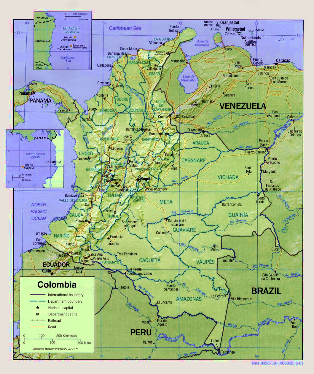
| Ìjúwe | Shaded relief map of Colombia. |
| Ọjọ́ọdún | circa 2001 |
| Orísun | http://www.lib.utexas.edu/maps/colombia.html |
| Olùdá | U.S. Central Intelligence Agency |
| Àwọn àtẹ̀jáde míràn |
|

Ìwé àṣẹ
| This image is a work of a Central Intelligence Agency employee, taken or made as part of that person's official duties. As a Work of the United States Government, this image or media is in the public domain in the United States.
|

|
Ìtàn fáìlì
Ẹ kan kliki lórí ọjọ́ọdún/àkókò kan láti wo fáìlì ọ̀ún bó ṣe hàn ní àkókò na.
| Ọjọ́ọdún/Àkókò | Àwòrán kékeré | Àwọn ìwọ̀n | Oníṣe | Àríwí | |
|---|---|---|---|---|---|
| lọ́wọ́ | 08:41, 31 Oṣù Kẹjọ 2007 | | 1,059 × 1,258 (4.74 MB) | F3rn4nd0 | Shaded relief map of Colombia. http://www.lib.utexas.edu/maps/colombia.html other version:thumb|center|200px {{PD-USGov-CIA}} Category:Maps of Colombia |
Ìlò fáìlì
Ojúewé kan yìí únlo fáìlì yí:
Ìlò fáìlì káàkiri
Àwọn wiki míràn wọ̀nyí lo fáìlì yìí:
- Ìlò ní es.wikipedia.org
- Ìlò ní fr.wikipedia.org
- Ìlò ní id.wikipedia.org
- Ìlò ní io.wikipedia.org
- Ìlò ní km.wikipedia.org
- Ìlò ní ko.wikipedia.org
- Ìlò ní uk.wikipedia.org
- Ìlò ní vi.wikipedia.org