
Fáìlì:Locator map of North Korea.svg

Size of this PNG preview of this SVG file: 250 × 115 pixels. Àwọn ìgbéhàn míràn: 320 × 147 pixels | 640 × 294 pixels | 1,024 × 471 pixels | 1,280 × 589 pixels | 2,560 × 1,178 pixels.
Fáìlì àtìbẹ̀rẹ̀ (faili SVG, pẹ̀lú 250 × 115 pixels, ìtòbi faili: 1.18 MB)
|
|
Fáìlì yìí wá láti Wikimedia Commons. Àròyé láti ojúewé ìjúwe rẹ̀ níbẹ̀ nìyí nísàlẹ̀. |
Àkótán
| Ìjúwe |
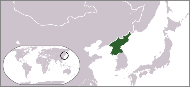
English: Locator map of North Korea. |
| Ọjọ́ọdún | |
| Orísun | Iṣẹ́ onítọ̀hún |
| Olùdá | Ksiom |
| Àwọn àtẹ̀jáde míràn |
Derivative works of this file: Locator map of North Korea 1945-50.svg  |
Ìwé àṣẹ
| Èmi gangan, tó jẹ́ pé èmi ni mo ni ẹ̀tọ́àwòkọ iṣẹ́ yìí, jọ̀wọ́ ìṣẹ́ yìí sínú ìgboro. Èyí kan gbogbo ayé. In some countries this may not be legally possible; if so: I grant anyone the right to use this work for any purpose, without any conditions, unless such conditions are required by law. |
Ìtàn fáìlì
Ẹ kan kliki lórí ọjọ́ọdún/àkókò kan láti wo fáìlì ọ̀ún bó ṣe hàn ní àkókò na.
| Ọjọ́ọdún/Àkókò | Àwòrán kékeré | Àwọn ìwọ̀n | Oníṣe | Àríwí | |
|---|---|---|---|---|---|
| lọ́wọ́ | 17:34, 10 Oṣù Keje 2009 | | 250 × 115 (1.18 MB) | Ksiom | revised version |
| 20:29, 19 Oṣù Kẹ̀wá 2008 |  | 250 × 115 (1.34 MB) | Ksiom | {{Information |Description={{en|1=Locator map of North Korea.}} |Source=Own work by uploader |Author=Ksiom |Date=2008-10-20 |Permission= |other_versions=Image:LocationNorthKorea.png }} <!--{{ImageUpload|full}}--> [[Category:Locator ma |
Ìlò fáìlì
Ojúewé kan yìí únlo fáìlì yí:
Ìlò fáìlì káàkiri
Àwọn wiki míràn wọ̀nyí lo fáìlì yìí:
- Ìlò ní as.wikipedia.org
- Ìlò ní az.wikipedia.org
- Ìlò ní bg.wikipedia.org
- Ìlò ní blk.wiktionary.org
- Ìlò ní bn.wikipedia.org
- Ìlò ní ca.wikipedia.org
- Ìlò ní de.wikipedia.org
- Ìlò ní de.wikinews.org
- Ìlò ní el.wikinews.org
- Ο ηγέτης της Βόρειας Κορέας ανήγγειλε ειρήνη με τη Νότιο Κορέα
- Πρότυπο:ΒόρειαΚορέα
- Τεχνητή σεισμική δόνηση στη Βόρεια Κορέα
- Η Βόρεια Κορέα ετοιμάζει για νέες πυρηνικές δοκιμές
- Οι προϋποθέσεις που έθεσε η Βόρεια Κορέα για την έναρξη συνομιλιών
- Σε εκτόξευση πυραύλου από υποβρύχιο προχώρησε η Βόρεια Κορέα
- Η Βόρεια Κορέα γιορτάζει την 105η επέτειο της γέννησης του Κιμ Ιλ Σουνγκ
- Εκτόξευση πυραύλου από τη Βόρεια Κορέα
- Η Ρωσία χρησιμοποίησε το δικαίωμα αρνησικυρίας για να αποτρέψει ψήφισμα του ΟΗΕ κατά της Βορείου Κορέας
- Χαμηλώνει η ένταση στην Κορεατική Χερσόνησο
- Καταδίκη της Βορείου Κορέας από το Συμβούλιο Ασφαλείας του ΟΗΕ
- Ìlò ní en.wikipedia.org
- Ìlò ní es.wikipedia.org
- Ìlò ní fa.wikipedia.org
- Ìlò ní fa.wikinews.org
- Ìlò ní fiu-vro.wikipedia.org
- Ìlò ní fr.wikinews.org
- Ìlò ní fr.wiktionary.org
- Ìlò ní gu.wikipedia.org
- Ìlò ní hif.wikipedia.org
- Ìlò ní id.wikipedia.org
- Ìlò ní it.wikivoyage.org
- Ìlò ní jam.wikipedia.org
- Ìlò ní ja.wikipedia.org
- Ìlò ní ja.wikinews.org
- Ìlò ní ja.wiktionary.org
- Ìlò ní ko.wikipedia.org
- Ìlò ní ko.wiktionary.org
- Ìlò ní kv.wikipedia.org
- Ìlò ní lo.wikipedia.org
- Ìlò ní mai.wikipedia.org
Ìfihàn ìlò míràn púpọ̀ fún fálì yìí.