
Fáìlì:Nagaland locator map.svg

Fáìlì àtìbẹ̀rẹ̀ (faili SVG, pẹ̀lú 2,393 × 1,956 pixels, ìtòbi faili: 277 KB)
|
|
Fáìlì yìí wá láti Wikimedia Commons. Àròyé láti ojúewé ìjúwe rẹ̀ níbẹ̀ nìyí nísàlẹ̀. |
| Àkólé |
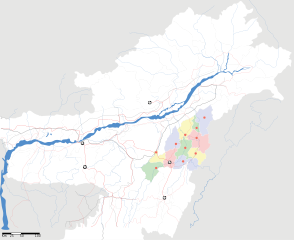
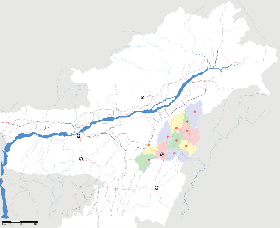
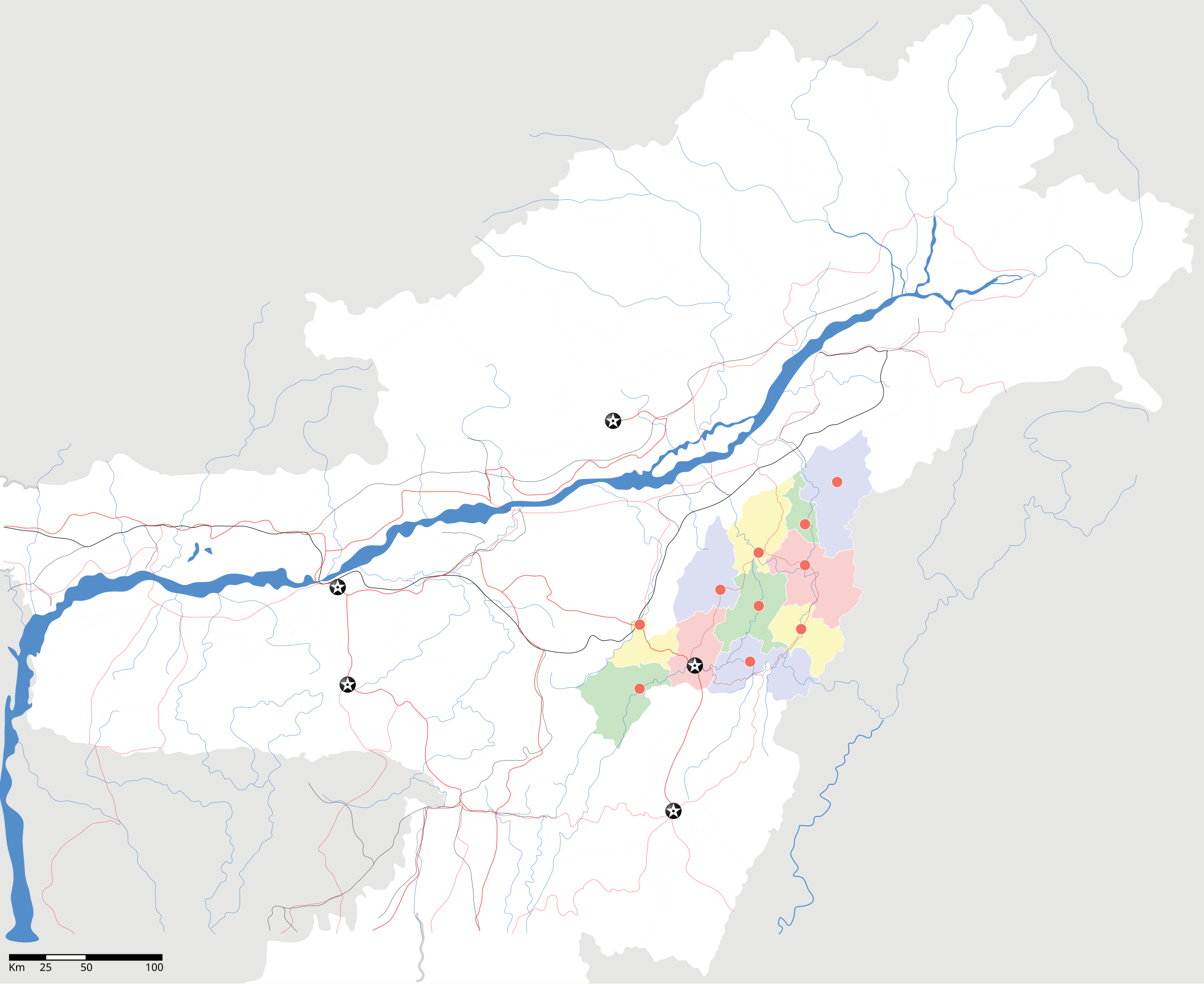
Nagaland locator Map |
| Description |
Map of w:Nagaland with road and rail lines. Equirectangular projection. Geographic limits of the map: top=29.49, bottom=23.74, left=89.61, right=97.52. |
| Ọjọ́ọdún | |
| Orísun |
Iṣẹ́ onítọ̀hún |
| Aṣèdá | |
| Ìyọ̀nda (Ìtúnlò fáìlì yìí) |
Èmi gangan, tó jẹ́ pé èmi ni mo ni ẹ̀tọ́àwòkọ iṣẹ́ yìí, fara mọ́ ọ láti tẹ̀ẹ́jáde lábẹ́ ìwé-àṣẹ ìsàlẹ̀ yìí: Fáìlì yìí wà lábẹ́ ìwé àṣẹ Creative Commons Ìdálórúkọ-Share Alike 3.0 Aláìkówọlé.
|
| Geotemporal data | |
| Date depicted | second half of 20 century àti 21 century |
| Georeferencing | If inappropriate please set warp_status = skip to hide. |
| Archival data | |
| Ìkíyèsí | Part of WikiProject India Maps |
Ìtàn fáìlì
Ẹ kan kliki lórí ọjọ́ọdún/àkókò kan láti wo fáìlì ọ̀ún bó ṣe hàn ní àkókò na.
| Ọjọ́ọdún/Àkókò | Àwòrán kékeré | Àwọn ìwọ̀n | Oníṣe | Àríwí | |
|---|---|---|---|---|---|
| lọ́wọ́ | 12:05, 17 Oṣù Kẹrin 2007 | | 2,393 × 1,956 (277 KB) | Planemad | not displaying, reupload |
| 12:00, 17 Oṣù Kẹrin 2007 |  | 2,393 × 1,956 (277 KB) | Planemad | not displaying, reupload | |
| 11:55, 17 Oṣù Kẹrin 2007 |  | 2,393 × 1,956 (277 KB) | Planemad | {{WikiProject_India_Maps |Title=Nagaland locator Map |Description=Map of w:Nagaland with road and rail lines |Source= [http://www.iitg.ernet.in/rcilts/assam_political.jpg IIT Guwahati - Assam Political map], [http://nagaland.nic.in/planning&coord/p |
Ìlò fáìlì
Ojúewé kan yìí únlo fáìlì yí:
Ìlò fáìlì káàkiri
Àwọn wiki míràn wọ̀nyí lo fáìlì yìí:
- Ìlò ní ar.wikipedia.org
- Ìlò ní ast.wikipedia.org
- Ìlò ní as.wikipedia.org
- Ìlò ní ba.wikipedia.org
- Ìlò ní bh.wikipedia.org
- Ìlò ní bn.wikipedia.org
- Ìlò ní ceb.wikipedia.org
- Ìlò ní de.wikipedia.org
- Ìlò ní en.wikipedia.org
- Ìlò ní en.wikinews.org
- Ìlò ní es.wikipedia.org
- Ìlò ní fa.wikipedia.org
- Ìlò ní hi.wikipedia.org
- Ìlò ní ja.wikipedia.org
- Ìlò ní kbd.wikipedia.org
- Ìlò ní ml.wikipedia.org
- Ìlò ní nl.wikipedia.org
- Ìlò ní or.wikipedia.org
- Ìlò ní pam.wikipedia.org
- Ìlò ní pa.wikipedia.org
- Ìlò ní pnb.wikipedia.org
- Ìlò ní sa.wikipedia.org
- Ìlò ní sw.wikipedia.org
- Ìlò ní ta.wikipedia.org
- Ìlò ní tr.wikipedia.org
- Ìlò ní vi.wikipedia.org
- Ìlò ní war.wikipedia.org
- Ìlò ní www.wikidata.org
- Ìlò ní zh.wikipedia.org