
Fáìlì:Ghana Map.jpg

Ìtóbi ìkọ́yẹ̀wò yìí: 489 × 599 pixels. Àwọn ìgbéhàn míràn: 196 × 240 pixels | 392 × 480 pixels | 627 × 768 pixels | 1,060 × 1,298 pixels.
Fáìlì àtìbẹ̀rẹ̀ (1,060 × 1,298 pixel, ìtóbi faili: 309 KB, irú MIME: image/jpeg)
|
|
Fáìlì yìí wá láti Wikimedia Commons. Àròyé láti ojúewé ìjúwe rẹ̀ níbẹ̀ nìyí nísàlẹ̀. |
Àkótán
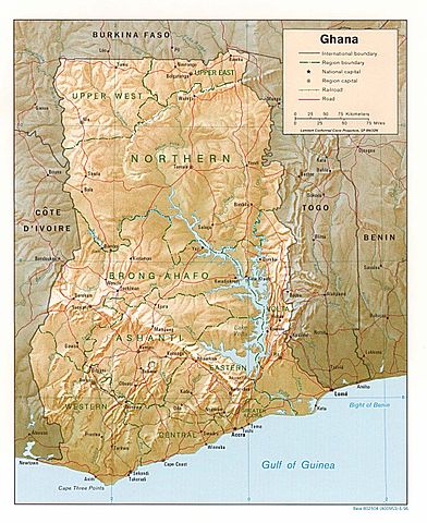
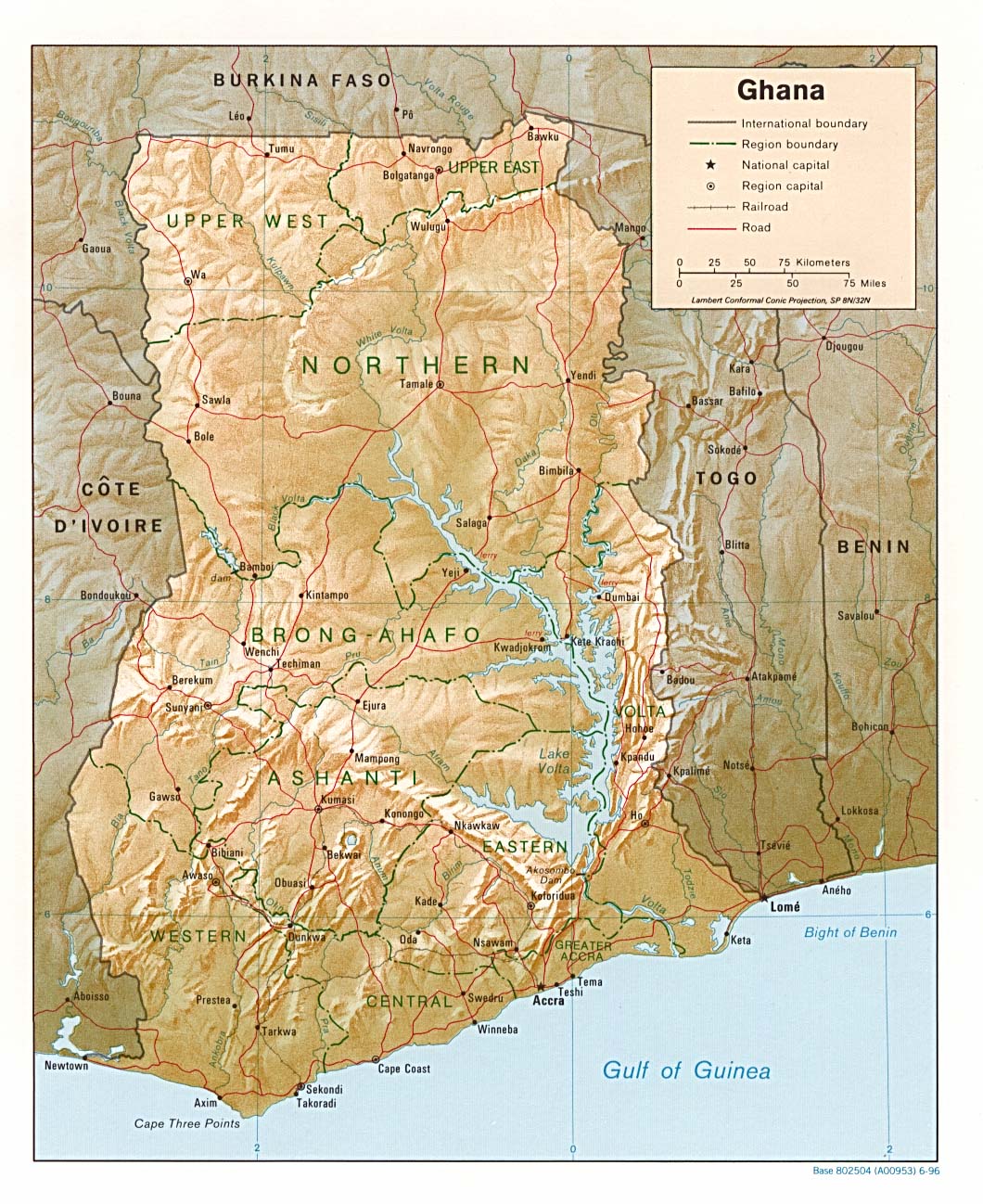
| Ìjúwe | Shaded relief map of Ghana, 1996, produced by the U.S. Central Intelligence Agency. |
| Ọjọ́ọdún | |
| Orísun | University of Texas Libraries, Perry-Castañeda Library Map Collection: Ghana maps |
| Olùdá | CIA |
Ìwé àṣẹ
| This image is a work of a Central Intelligence Agency employee, taken or made as part of that person's official duties. As a Work of the United States Government, this image or media is in the public domain in the United States.
|

|
Ìtàn fáìlì
Ẹ kan kliki lórí ọjọ́ọdún/àkókò kan láti wo fáìlì ọ̀ún bó ṣe hàn ní àkókò na.
| Ọjọ́ọdún/Àkókò | Àwòrán kékeré | Àwọn ìwọ̀n | Oníṣe | Àríwí | |
|---|---|---|---|---|---|
| lọ́wọ́ | 18:46, 3 Oṣù Kẹjọ 2006 | | 1,060 × 1,298 (309 KB) | DO11.10 | Shaded relief map of Ghana. Image source: [http://www.lib.utexas.edu/maps/africa/ghana_rel95.jpg], from the [http://www.lib.utexas.edu/maps/ghana.html Perry-Castañeda Library Map Collection]. {{PD-USGov-CIA}} Category:Maps of Ghana |
| 10:50, 21 Oṣù Kejì 2006 |  | 1,341 × 1,653 (570 KB) | Lupo | Shaded relief map of Ghana. Image source: [http://www.lib.utexas.edu/maps/africa/ghana_rel95.jpg], from the [http://www.lib.utexas.edu/maps/ghana.html Perry-Castañeda Library Map Collection]. {{PD-USGov-CIA}} Category:Maps of Ghana |
Ìlò fáìlì
Ojúewé kan yìí únlo fáìlì yí:
Ìlò fáìlì káàkiri
Àwọn wiki míràn wọ̀nyí lo fáìlì yìí:
- Ìlò ní ast.wikipedia.org
- Ìlò ní avk.wikipedia.org
- Ìlò ní br.wikipedia.org
- Ìlò ní de.wikipedia.org
- Ìlò ní en.wikipedia.org
- Ìlò ní es.wikipedia.org
- Ìlò ní fa.wikipedia.org
- Ìlò ní fr.wikipedia.org
- Ìlò ní gag.wikipedia.org
- Ìlò ní gd.wikipedia.org
- Ìlò ní gl.wikipedia.org
- Ìlò ní hr.wiktionary.org
- Ìlò ní id.wikipedia.org
- Ìlò ní it.wikipedia.org
- Ìlò ní lfn.wikipedia.org
- Ìlò ní lt.wikipedia.org
- Ìlò ní ms.wikipedia.org
- Ìlò ní pl.wikipedia.org
- Ìlò ní simple.wikipedia.org
- Ìlò ní sr.wikipedia.org
- Ìlò ní tr.wikipedia.org
- Ìlò ní uk.wikipedia.org
- Ìlò ní vec.wikipedia.org
- Ìlò ní wa.wikipedia.org
- Ìlò ní zh.wikipedia.org