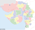
Fáìlì:Gujarat locator map.svg

Size of this PNG preview of this SVG file: 719 × 600 pixels. Àwọn ìgbéhàn míràn: 288 × 240 pixels | 576 × 480 pixels | 921 × 768 pixels | 1,228 × 1,024 pixels | 2,456 × 2,048 pixels | 2,145 × 1,789 pixels.
Fáìlì àtìbẹ̀rẹ̀ (faili SVG, pẹ̀lú 2,145 × 1,789 pixels, ìtòbi faili: 247 KB)
Ìtàn fáìlì
Ẹ kan kliki lórí ọjọ́ọdún/àkókò kan láti wo fáìlì ọ̀ún bó ṣe hàn ní àkókò na.
| Ọjọ́ọdún/Àkókò | Àwòrán kékeré | Àwọn ìwọ̀n | Oníṣe | Àríwí | |
|---|---|---|---|---|---|
| lọ́wọ́ | 11:03, 7 Oṣù Kàrún 2007 |  | 2,145 × 1,789 (247 KB) | Planemad | complete |
| 17:31, 6 Oṣù Kàrún 2007 |  | 2,145 × 1,789 (225 KB) | Planemad | {{WikiProject_India_Maps |Title=Gujarat locator map |Description=Map of w:Gujarat with road and rail lines (incomplete) |Source= [http://astro.temple.edu/~gblum/Fotos/PHOTOS%20TO%20EMAIL/Gujarat_Map.jpg Gujarat Map] |Date=May 2007 |Author=[[w:user:Pla |
Ìlò fáìlì
Ojúewé kan yìí únlo fáìlì yí:
Ìlò fáìlì káàkiri
Àwọn wiki míràn wọ̀nyí lo fáìlì yìí:
- Ìlò ní ast.wikipedia.org
- Ìlò ní bn.wikipedia.org
- Ìlò ní de.wikipedia.org
- Ìlò ní en.wikipedia.org
- Ìlò ní hi.wikipedia.org
- Ìlò ní hr.wikipedia.org
- Ìlò ní ja.wikipedia.org
- Ìlò ní lez.wikipedia.org
- Ìlò ní mai.wikipedia.org
- Ìlò ní ml.wikipedia.org
- Ìlò ní mr.wikipedia.org
- अबडासा विधानसभा मतदारसंघ
- मांडवी विधानसभा मतदारसंघ
- भूज विधानसभा मतदारसंघ
- अंजार विधानसभा मतदारसंघ
- गांधीधाम विधानसभा मतदारसंघ
- वाव विधानसभा मतदारसंघ
- डीसा विधानसभा मतदारसंघ
- देवदार विधानसभा मतदारसंघ
- कांकरेज विधानसभा मतदारसंघ
- राधनपूर विधानसभा मतदारसंघ
- चाणस्मा विधानसभा मतदारसंघ
- पाटण (गुजरात) विधानसभा मतदारसंघ
- सिद्धपूर विधानसभा मतदारसंघ
- खेराळू विधानसभा मतदारसंघ
- उंझा विधानसभा मतदारसंघ
- वीसनगर विधानसभा मतदारसंघ
- बेचराजी विधानसभा मतदारसंघ
- कडी विधानसभा मतदारसंघ
- महेसाणा विधानसभा मतदारसंघ
- विजापूर विधानसभा मतदारसंघ
Ìfihàn ìlò míràn púpọ̀ fún fálì yìí.
