
Fáìlì:Manhattan Highlight New York City Map Julius Schorzman.png

Ìtóbi ìkọ́yẹ̀wò yìí: 616 × 600 pixels. Àwọn ìgbéhàn míràn: 247 × 240 pixels | 493 × 480 pixels | 789 × 768 pixels | 1,052 × 1,024 pixels | 2,104 × 2,048 pixels | 2,652 × 2,582 pixels.
Fáìlì àtìbẹ̀rẹ̀ (2,652 × 2,582 pixel, ìtóbi faili: 4.68 MB, irú MIME: image/png)
|
|
Fáìlì yìí wá láti Wikimedia Commons. Àròyé láti ojúewé ìjúwe rẹ̀ níbẹ̀ nìyí nísàlẹ̀. |
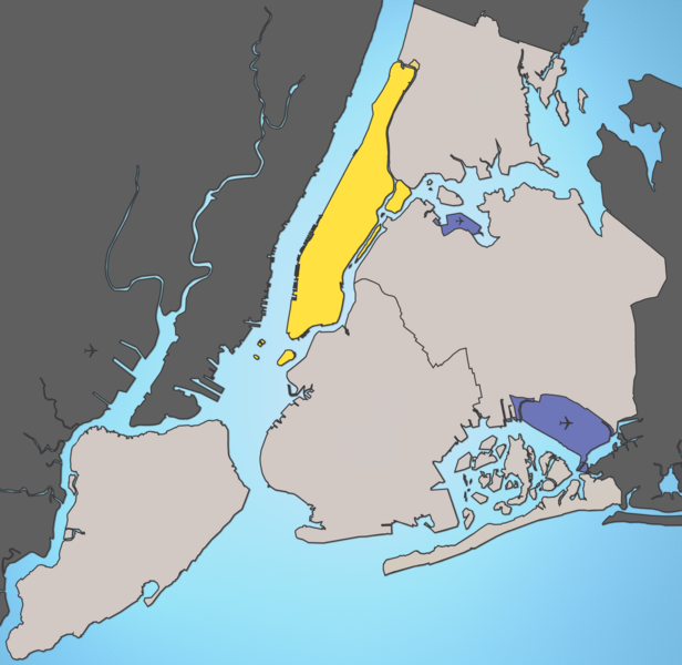
A map of New York City with Manhattan highlighted.
Notes:
- Marble Hill is shown as part Manhattan, part Bronx. See Wikipedia:Marble Hill, Manhattan, New York for more information.
- Governors Island, Ellis Island, Liberty Island, Randall's Island, and Roosevelt Island are highlighted since they are in New York County and are governmentally a part of Manhattan.
Source: I created this image using various maps and images. Attribution: Julius Schorzman
Fáìlì yìí wà lábẹ́ ìwé àṣẹ Creative Commons Ìdálórúkọ-Share Alike 2.5 Gbogbogbò.
- Ẹ ní ààyè:
- láti pín pẹ̀lú ẹlòmíràn – láti ṣàwòkọ, pínkiri àti ṣàgbéká iṣẹ́ náà
- láti túndàpọ̀ – láti mulò mọ́ iṣẹ́ míràn
- Lábẹ́ àwọn àdéhùn wọ̀nyí:
- ìdárúkọ – Ẹ gbọdọ̀ ṣe ọ̀wọ̀ tó yẹ, pèsè ìjápọ̀ sí ìwé-àṣe, kí ẹ sì sọ bóyá ìyípadà wáyé. Ẹ le ṣe èyí lórísi ọ̀nà tó bojúmu, sùgbọ́n tí kò ní dà bii pé oníìwé-àṣe fọwọ́ sí yín tàbí lílò yín.
- share alike – Tó bá ṣe pé ẹ ṣ'àtúndàlú, ṣàyípadà, tàbí ṣ'àgbélé sí iṣẹ́-ọwọ́ náà, ẹ lè ṣe ìgbésíta àfikún yín lábẹ́ ìwé-àṣẹ kannáà tàbí tójọra mọ́ ti àtilẹ̀wa.
Ìtàn fáìlì
Ẹ kan kliki lórí ọjọ́ọdún/àkókò kan láti wo fáìlì ọ̀ún bó ṣe hàn ní àkókò na.
| Ọjọ́ọdún/Àkókò | Àwòrán kékeré | Àwọn ìwọ̀n | Oníṣe | Àríwí | |
|---|---|---|---|---|---|
| lọ́wọ́ | 01:59, 19 Oṣù Kẹjọ 2005 | | 2,652 × 2,582 (4.68 MB) | Quasipalm | A map of New York City with Manhattan highlighted. Notes: # '''Marble Hill''' is shown as part Manhattan, part Bronx. See wiki:Marble Hill for more information. # '''Governors Island''', '''Ellis Island''', '''Liberty Island''', '''Randall's Island' |
| 01:54, 19 Oṣù Kẹjọ 2005 |  | 2,652 × 2,582 (4.68 MB) | Quasipalm | A map of New York City with Manhattan highlighted. Notes: # '''Marble Hill''' is shown as part Manhattan, part Bronx. See wiki:Marble Hill for more information. # '''Governors Island''', '''Ellis Island''', '''Liberty Island''', '''Randall's Island' |
Ìlò fáìlì
Ojúewé kan yìí únlo fáìlì yí:
Ìlò fáìlì káàkiri
Àwọn wiki míràn wọ̀nyí lo fáìlì yìí:
- Ìlò ní bg.wikipedia.org
- Ìlò ní bn.wikipedia.org
- Ìlò ní bs.wikipedia.org
- Ìlò ní ca.wikipedia.org
- Ìlò ní de.wikipedia.org
- Ìlò ní en.wikipedia.org
- Ìlò ní es.wikipedia.org
- Ìlò ní fa.wikipedia.org
- Ìlò ní fo.wikipedia.org
- Ìlò ní frr.wikipedia.org
- Ìlò ní fr.wikipedia.org
- Ìlò ní ga.wikipedia.org
- Ìlò ní he.wikipedia.org
- Ìlò ní hr.wikipedia.org
- Ìlò ní hu.wikipedia.org
- Ìlò ní id.wikipedia.org
- Ìlò ní is.wikipedia.org
- Ìlò ní it.wikipedia.org
- Ìlò ní ja.wikipedia.org
- Ìlò ní ka.wikipedia.org
- Ìlò ní kn.wikipedia.org
- Ìlò ní lt.wikipedia.org
- Ìlò ní mk.wikipedia.org
- Ìlò ní mr.wikipedia.org
- Ìlò ní ms.wikipedia.org
- Ìlò ní pcd.wikipedia.org
- Ìlò ní pnb.wikipedia.org
- Ìlò ní pt.wikipedia.org
- Ìlò ní ro.wikipedia.org
- Ìlò ní ru.wikipedia.org
Ìfihàn ìlò míràn púpọ̀ fún fálì yìí.