
Fáìlì:Map-Latin America2.png
Kò sí ìgbéhàn gíga jù báun lọ.
Map-Latin_America2.png (390 × 450 pixel, ìtóbi faili: 22 KB, irú MIME: image/png)
|
|
Fáìlì yìí wá láti Wikimedia Commons. Àròyé láti ojúewé ìjúwe rẹ̀ níbẹ̀ nìyí nísàlẹ̀. |

|
This linguistic map image could be re-created using vector graphics as an SVG file. This has several advantages; see Commons:Media for cleanup for more information. If an SVG form of this image is available, please upload it and afterwards replace this template with
{{vector version available|new image name}}.
It is recommended to name the SVG file “Map-Latin America2.svg”—then the template Vector version available (or Vva) does not need the new image name parameter. |
Àkótán
Español: Ubicación de América Latina

.
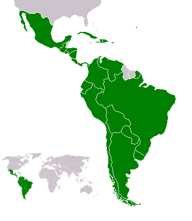
Map of en:Latin america. Thanks to write in the talk page if it's need to improve it. An alternative image is Image:Map-Latin America.png.
Map made from Image:BlankMap-World.png
Ìwé àṣẹ
Yug, tó ni ẹ̀tọ́àwòkọ iṣẹ́ yìí, fara mọ́ ọ láti tẹ̀ẹ́jáde lábẹ́ ìwé-àṣẹ ìsàlẹ̀ yìí:
| Èmi gangan, tó jẹ́ pé èmi ni mo ni ẹ̀tọ́àwòkọ iṣẹ́ yìí, jọ̀wọ́ ìṣẹ́ yìí sínú ìgboro. Èyí kan gbogbo ayé. In some countries this may not be legally possible; if so: I grant anyone the right to use this work for any purpose, without any conditions, unless such conditions are required by law. |
Atlas
This map should be added to the Wikimedia Atlas.
derivative works
Derivative works of this file: Map-Latin America2-2.png
Ìtàn fáìlì
Ẹ kan kliki lórí ọjọ́ọdún/àkókò kan láti wo fáìlì ọ̀ún bó ṣe hàn ní àkókò na.
| Ọjọ́ọdún/Àkókò | Àwòrán kékeré | Àwọn ìwọ̀n | Oníṣe | Àríwí | |
|---|---|---|---|---|---|
| lọ́wọ́ | 22:23, 18 Oṣù Kejì 2018 | | 390 × 450 (22 KB) | Andrew J.Kurbiko | minor fix |
| 16:14, 20 Oṣù Kẹta 2011 |  | 390 × 450 (25 KB) | Philip Stevens | The Falkland Islands are not part of Latin America. | |
| 11:47, 7 Oṣù Kejìlá 2008 |  | 390 × 450 (23 KB) | Osado | {{Information |Description= |Source= |Date= |Author= |Permission= |other_versions= }} | |
| 07:07, 20 Oṣù Kẹ̀wá 2008 |  | 390 × 450 (21 KB) | Pruxo | malvinas part of latinoamerica | |
| 16:02, 15 Oṣù Kẹ̀wá 2008 |  | 390 × 450 (21 KB) | Pruxo | mejora de "Imagen:Map-Latin America2.png", agregando islas en chile, agregando las Islas malvinas (o falklands) con color neutral, pasando la Guayana francesa junto con las demas guayanas (es territorio de ultramar frances, si fuera latinoamerica, quevec | |
| 21:55, 25 Oṣù Kejì 2006 |  | 390 × 450 (22 KB) | NoIdeaNick~commonswiki | Changed map to reflect the fact that Jamaica is not part of Latin America. | |
| 14:36, 19 Oṣù Kínní 2006 |  | 390 × 450 (23 KB) | NoIdeaNick~commonswiki | Just a little change to the color of Belize. | |
| 23:29, 21 Oṣù Kejìlá 2005 |  | 390 × 450 (20 KB) | Yug | Zoom |
Ìlò fáìlì
Ojúewé kan yìí únlo fáìlì yí:
Ìlò fáìlì káàkiri
Àwọn wiki míràn wọ̀nyí lo fáìlì yìí:
- Ìlò ní af.wikipedia.org
- Ìlò ní arc.wikipedia.org
- Ìlò ní azb.wikipedia.org
- Ìlò ní az.wikipedia.org
- Ìlò ní br.wikipedia.org
- Ìlò ní br.wiktionary.org
- Ìlò ní ckb.wikipedia.org
- Ìlò ní cv.wikipedia.org
- Ìlò ní cy.wikipedia.org
- Ìlò ní da.wikipedia.org
- Ìlò ní de.wikipedia.org
- Ìlò ní de.wiktionary.org
- Ìlò ní en.wikipedia.org
- Latin America
- User:Dimadick
- Afro–Latin Americans
- User:Nivenus
- Wikipedia:Featured content/Portals
- User:Mikhajist
- User:Zdunne
- User:CatatonicStupor
- Wikipedia:Association of Hispanic and Latin American writers
- User:J. Finkelstein/Sandbox/LatinAmericaInfobox
- User:Es-arturus
- Etiquette in Latin America
- Water supply and sanitation in Latin America
- User:Adam sk
- Wikipedia:Articles for deletion/Log/2007 February 10
- Wikipedia:Articles for deletion/Latino Muslims
- Talk:Latin America/Archive 1
- User:Mvblair
- User:Tcd88
- User:Mikhajist/Userboxes
- User:Zero Gravity/Proposal
- User:Andreasmperu
- Wikipedia:Graphics Lab/Image workshop/Archive/May 2009
- User:Mosemamenti
- User:Mvblair/Userboxes/Latin American History
- User:Richie Boy 5
- User:Mosemamenti/Usuario:Mosemamenti
- User:Fcassia
- User:Samwb123/fp
- User:Saukkomies/My userboxes
- User:IANVS
- User:AKABumba
- User:Daguerrero
- User:Clarkp/Userboxes
- User:Hpav7
- User:Evanex
Ìfihàn ìlò míràn púpọ̀ fún fálì yìí.