
Fáìlì:Map of Christmas Island 1976.jpg

Ìtóbi ìkọ́yẹ̀wò yìí: 657 × 600 pixels. Àwọn ìgbéhàn míràn: 263 × 240 pixels | 526 × 480 pixels | 839 × 766 pixels.
Fáìlì àtìbẹ̀rẹ̀ (839 × 766 pixel, ìtóbi faili: 692 KB, irú MIME: image/jpeg)
|
|
Fáìlì yìí wá láti Wikimedia Commons. Àròyé láti ojúewé ìjúwe rẹ̀ níbẹ̀ nìyí nísàlẹ̀. |
Àkótán
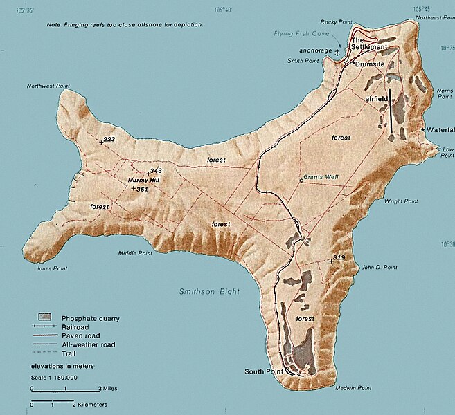
| Ìjúwe | Map of Christmas. This map was produced by the U.S. Central Intelligence Agency, unless otherwise indicated. Maps dated 1976 were taken from The Indian Ocean Atlas, published by the Central Intelligence Agency. |
| Ọjọ́ọdún | dated 1976 |
| Orísun | http://www.lib.utexas.edu/maps/islands_oceans_poles/christmas_island_76.jpg |
| Olùdá | Unknown author |
Ìwé àṣẹ
| This image is a work of a Central Intelligence Agency employee, taken or made as part of that person's official duties. As a Work of the United States Government, this image or media is in the public domain in the United States.
|

|
Ìtàn fáìlì
Ẹ kan kliki lórí ọjọ́ọdún/àkókò kan láti wo fáìlì ọ̀ún bó ṣe hàn ní àkókò na.
| Ọjọ́ọdún/Àkókò | Àwòrán kékeré | Àwọn ìwọ̀n | Oníṣe | Àríwí | |
|---|---|---|---|---|---|
| lọ́wọ́ | 15:24, 3 Oṣù Kejì 2018 | | 839 × 766 (692 KB) | Hohum | Cleanup |
| 20:33, 18 Oṣù Kejìlá 2010 |  | 839 × 766 (365 KB) | Ras67 | cropped | |
| 19:15, 11 Oṣù Kejì 2006 |  | 839 × 774 (128 KB) | Walden69 | Map of Christmas. This map were produced by the U.S. Central Intelligence Agency, unless otherwise indicated. Maps dated 1976 were taken from The Indian Ocean Atlas, published by the Central Intelligence Agency. {{PD-USGov-CIA}} |
Ìlò fáìlì
Kò sí ojúewé tó únlo fáìlì yìí.
Ìlò fáìlì káàkiri
Àwọn wiki míràn wọ̀nyí lo fáìlì yìí:
- Ìlò ní ar.wikipedia.org
- Ìlò ní arz.wikipedia.org
- Ìlò ní ast.wikipedia.org
- Ìlò ní bs.wikipedia.org
- Ìlò ní ca.wikipedia.org
- Ìlò ní ceb.wikipedia.org
- Ìlò ní de.wikipedia.org
- Ìlò ní el.wikipedia.org
- Ìlò ní en.wikipedia.org
- Christmas Island
- Christmas Island Airport
- Christmas imperial pigeon
- Postage stamps and postal history of Christmas Island
- List of butterflies of Australia
- Murray Hill, Christmas Island
- List of moths of Christmas Island
- Christmas Island Phosphate Co.'s Railway
- Christmas Island flying fox
- Wildlife of Christmas Island
- Ìlò ní en.wikiversity.org
- Ìlò ní en.wikivoyage.org
- Ìlò ní eo.wikipedia.org
- Ìlò ní es.wikipedia.org
- Ìlò ní et.wikipedia.org
- Ìlò ní eu.wikipedia.org
- Ìlò ní fa.wikipedia.org
- Ìlò ní fr.wikipedia.org
- Ìlò ní gl.wikipedia.org
- Ìlò ní gu.wikipedia.org
- Ìlò ní hi.wikipedia.org
- Ìlò ní hi.wiktionary.org
- Ìlò ní hu.wikipedia.org
- Ìlò ní it.wikipedia.org
- Ìlò ní ja.wikipedia.org
- Ìlò ní kk.wikipedia.org
- Ìlò ní la.wikipedia.org
- Ìlò ní lld.wikipedia.org
- Ìlò ní ml.wikipedia.org
- Ìlò ní ms.wikipedia.org
Ìfihàn ìlò míràn púpọ̀ fún fálì yìí.