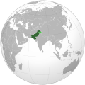
Fáìlì:Pakistan (orthographic projection).svg

Size of this PNG preview of this SVG file: 541 × 541 pixels. Àwọn ìgbéhàn míràn: 240 × 240 pixels | 480 × 480 pixels | 768 × 768 pixels | 1,024 × 1,024 pixels | 2,048 × 2,048 pixels.
Fáìlì àtìbẹ̀rẹ̀ (faili SVG, pẹ̀lú 541 × 541 pixels, ìtòbi faili: 268 KB)
Ìtàn fáìlì
Ẹ kan kliki lórí ọjọ́ọdún/àkókò kan láti wo fáìlì ọ̀ún bó ṣe hàn ní àkókò na.
| Ọjọ́ọdún/Àkókò | Àwòrán kékeré | Àwọn ìwọ̀n | Oníṣe | Àríwí | |
|---|---|---|---|---|---|
| lọ́wọ́ | 06:32, 17 Oṣù Kọkànlá 2021 |  | 541 × 541 (268 KB) | Gotitbro | Reverted to version as of 19:17, 10 November 2021 (UTC) gain consensus on enwiki or here, rather than edit warring; FWIW the discussion was on the svg editor's talk |
| 08:22, 12 Oṣù Kọkànlá 2021 |  | 541 × 541 (280 KB) | Ytpks896 | Reverted to version as of 06:39, 24 October 2021 (UTC) All sources are provided for this, your self made discussion on your talk page doesn't matter, if you want to dispute it the start discussion on File talk page not yours | |
| 19:17, 10 Oṣù Kọkànlá 2021 |  | 541 × 541 (268 KB) | Gotitbro | Reverted to version as of 05:04, 11 October 2021 (UTC) there is a linked discussion in the ES, no consensus at either enwiki or commons | |
| 06:39, 24 Oṣù Kẹ̀wá 2021 |  | 541 × 541 (280 KB) | Ytpks896 | Reverted to version as of 10:39, 16 September 2021 (UTC) rvt this territory is disputed & claimed by the Pakistan, and also territory was included in official map of Pakistan all sources was provided about this, removing territory from map and providing summary not a 'new' claim; without any source or reference this is not a logic. | |
| 05:04, 11 Oṣù Kẹ̀wá 2021 |  | 541 × 541 (268 KB) | Gotitbro | Reverted to version as of 16:08, 13 May 2020 (UTC) rvt contentious, not a 'new' claim; see User talk:Goran tek-en | |
| 10:39, 16 Oṣù Kẹ̀sán 2021 |  | 541 × 541 (280 KB) | Veverve | Reverted to version as of 12:10, 14 August 2021 (UTC) see summary for the source | |
| 08:10, 16 Oṣù Kẹ̀sán 2021 |  | 541 × 541 (168 KB) | Ksh.andronexus | Reverted to version as of 08:08, 16 September 2021 (UTC) | |
| 08:09, 16 Oṣù Kẹ̀sán 2021 |  | 541 × 541 (268 KB) | Ksh.andronexus | Reverted to version as of 08:06, 16 September 2021 (UTC) | |
| 08:08, 16 Oṣù Kẹ̀sán 2021 |  | 541 × 541 (168 KB) | Ksh.andronexus | Reverted to version as of 02:40, 9 January 2017 (UTC) | |
| 08:06, 16 Oṣù Kẹ̀sán 2021 |  | 541 × 541 (268 KB) | Ksh.andronexus | Is Pakistan on drugs to claim junagarh, please add a reference that is considerable, vandalising wiki leads to ban |
Ìlò fáìlì
Ojúewé kan yìí únlo fáìlì yí:
Ìlò fáìlì káàkiri
Àwọn wiki míràn wọ̀nyí lo fáìlì yìí:
- Ìlò ní ace.wikipedia.org
- Ìlò ní ady.wikipedia.org
- Ìlò ní af.wikipedia.org
- Ìlò ní ami.wikipedia.org
- Ìlò ní ar.wikipedia.org
- Ìlò ní ar.wiktionary.org
- Ìlò ní as.wikipedia.org
- Ìlò ní av.wikipedia.org
- Ìlò ní awa.wikipedia.org
- Ìlò ní azb.wikipedia.org
- Ìlò ní az.wiktionary.org
- Ìlò ní ba.wikipedia.org
- Ìlò ní bcl.wikipedia.org
- Ìlò ní bh.wikipedia.org
- Ìlò ní bn.wikipedia.org
- Ìlò ní bo.wikipedia.org
- Ìlò ní bpy.wikipedia.org
- Ìlò ní bxr.wikipedia.org
- Ìlò ní cdo.wikipedia.org
- Ìlò ní ceb.wikipedia.org
- Ìlò ní chr.wikipedia.org
- Ìlò ní ch.wikipedia.org
- Ìlò ní crh.wikipedia.org
- Ìlò ní cs.wikipedia.org
- Ìlò ní cu.wikipedia.org
- Ìlò ní cv.wikipedia.org
- Ìlò ní da.wikipedia.org
- Ìlò ní dty.wikipedia.org
- Ìlò ní el.wikipedia.org
- Ìlò ní en.wikipedia.org
Ìfihàn ìlò míràn púpọ̀ fún fálì yìí.


