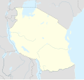
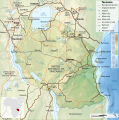
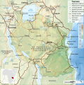
Fáìlì:Tanzania location map.svg

Page contents not supported in other languages.
Lát'ọwọ́ Wikipedia, ìwé ìmọ̀ ọ̀fẹ́

Fáìlì àtìbẹ̀rẹ̀(faili SVG, pẹ̀lú 3,302 × 3,143 pixels, ìtòbi faili: 1.04 MB)

Àkótán

Ìjúwe
Afrikaans: Liggingkaart van Tanzanië
English: Location map of Tanzania
Español: Mapa de georreferenciación de Tanzania
Français : Carte de géolocalisation de la Tanzanie
Equirectangular projection. 0.25° N, 28° W, 42° E, -13° S. Center : -6.375 35
Ọjọ́ọdún (UTC)
Orísun
Olùdá
Àwọn àtẹ̀jáde míràn

Derivative works of this file:  Iringa Regionen.png [àtúnṣe]

Ìdálórúkọ
(required by the license)
InfoField
© Sémhur / Wikimedia Commons / 
© Sémhur / Wikimedia Commons
SVG
InfoField
 
W3C-validity not checked.
 
This W3C-unspecified vector image was created with Inkscape…important .
This is a retouched picture, which means that it has been digitally altered from its original version. Modifications: Cropped, and prepared for geolocation.. The original can be viewed here: Tanzania map-fr.svg. Modifications made by Sémhur.

Graphic Lab
InfoField
Object location6° 22′ 30″ S, 35° 00′ 00″ E  Heading=1° Kartographer map based on OpenStreetMap.View this and other nearby images on: OpenStreetMapinfo

Ìwé àṣẹ

Èmi gangan, tó jẹ́ pé èmi ni mo ni ẹ̀tọ́àwòkọ iṣẹ́ yìí, fara mọ́ ọ láti tẹ̀ẹ́jáde lábẹ́ àwọn ìwé-àṣẹ ìsàlẹ̀ yìí:
w:en:Creative Commons
ìdárúkọ share alike
This file is licensed under the Creative Commons Attribution-Share Alike 4.0 International, 3.0 Unported, 2.5 Generic, 2.0 Generic and 1.0 Generic license.
Ẹ ní ààyè:
  • láti pín pẹ̀lú ẹlòmíràn – láti ṣàwòkọ, pínkiri àti ṣàgbéká iṣẹ́ náà
  • láti túndàpọ̀ – láti mulò mọ́ iṣẹ́ míràn
Lábẹ́ àwọn àdéhùn wọ̀nyí:
  • ìdárúkọ – Ẹ gbọdọ̀ ṣe ọ̀wọ̀ tó yẹ, pèsè ìjápọ̀ sí ìwé-àṣe, kí ẹ sì sọ bóyá ìyípadà wáyé. Ẹ le ṣe èyí lórísi ọ̀nà tó bojúmu, sùgbọ́n tí kò ní dà bii pé oníìwé-àṣe fọwọ́ sí yín tàbí lílò yín.
  • share alike – Tó bá ṣe pé ẹ ṣ'àtúndàlú, ṣàyípadà, tàbí ṣ'àgbélé sí iṣẹ́-ọwọ́ náà, ẹ lè ṣe ìgbésíta àfikún yín lábẹ́ ìwé-àṣẹ kannáà tàbí tójọra mọ́ ti àtilẹ̀wa.
Licence Art Libre Copyleft: Iṣẹ́ ọnà yìí jẹ́ ọ̀fẹ́; ẹ le ṣàtúnpínkiri rẹ̀ àti/tàbí ṣàtúnṣe rẹ̀ gẹ́gẹ́bí àwọn ọ̀rọ̀ àdéhùn Free Art License. Ẹ ó rìí àpẹrẹ ìwé-áṣẹ yìí lórí ibùdó Copyleft Attitude àti lórí àwọn ibùdọ́ míràn.
Ẹ le ṣàmúyàn ìwé-àṣẹ tí ó wù yín.

Original upload log

This image is a derivative work of the following images:

  • File:Tanzania_map-fr.svg licensed with Cc-by-sa-3.0,2.5,2.0,1.0, GFDL
    • 2009-03-20T13:30:18Z Sémhur 3096x3113 (3225659 Bytes) Ol Doinyo Lengaï was misplaced
    • 2009-03-20T11:14:35Z Sémhur 3096x3113 (3224368 Bytes) Add location map and few summits.
    • 2009-03-19T17:14:13Z Sémhur 3096x3113 (3099209 Bytes) grrr...
    • 2009-03-19T17:08:18Z Sémhur 3096x3113 (3099244 Bytes) Oups ! It wasn't the valid one.
    • 2009-03-19T17:05:02Z Sémhur 3096x3113 (3122421 Bytes) {{Information |Description={{en|1=Map of [[:en:Tanzania]].}} {{fr|1=Carte de la [[:fr:Tanzanie]].}} {{es|1=Mapa de [[:es:Tanzania]].}} |Source=travail personnel (own work). Sources of data: * Elevations : NASA SRTM3 (public d

Uploaded with derivativeFX

Original upload log

date/time username resolution size edit summary
2009-05-03T08:48:31Z User:Sémhur 3096×2947 828.71Kb borders above waters
2009-05-03T08:45:18Z User:Sémhur 3096×2947 828.72Kb Adding border between Arusha and Manyara
2009-05-01T18:46:42Z User:Sémhur 3096×2947 822.6Kb {{int:summary}} {{Information |Description={{en|1=Location map of [[:en:Tanzania]].}} {{fr|1=Carte de géolocalisation de la [[:fr:Tanzanie]].}} {{es|1=Mapa de georreferenciación de [[:es:Tanzania]].}} Equirectangular projection. 0.25° N, 28° W, 42°

akole

Ṣafikun alaye ila kan ti ohun ti faili yii duro
Location map of Tanzania

Awọn nkan ṣe afihan ninu faili yii

depicts Èdè Gẹ̀ẹ́sì

map Èdè Gẹ̀ẹ́sì

copyright status Èdè Gẹ̀ẹ́sì

copyrighted Èdè Gẹ̀ẹ́sì

1 Oṣù Kàrún 2009

coordinates of depicted place Èdè Gẹ̀ẹ́sì

6°S, 35°E

heading Èdè Gẹ̀ẹ́sì: 1 degree

MIME type Èdè Gẹ̀ẹ́sì

image/svg+xml

Ìtàn fáìlì

Ẹ kan kliki lórí ọjọ́ọdún/àkókò kan láti wo fáìlì ọ̀ún bó ṣe hàn ní àkókò na.

Ọjọ́ọdún/ÀkókòÀwòrán kékeréÀwọn ìwọ̀nOníṣeÀríwí
lọ́wọ́20:15, 25 Oṣù Kàrún 2017Àwòrán kékeré fún ní 20:15, 25 Oṣù Kàrún 20173,302 × 3,143 (1.04 MB)SémhurUpdated with Songwe Region
14:16, 13 Oṣù Kejìlá 2013Àwòrán kékeré fún ní 14:16, 13 Oṣù Kejìlá 20133,096 × 2,947 (1.03 MB)SémhurUpdated with the four new regions
00:30, 25 Oṣù Keje 2009Àwòrán kékeré fún ní 00:30, 25 Oṣù Keje 20093,096 × 2,947 (829 KB)BetacommandBotmove approved by: User:Sémhur This image was moved from File:Tanzania location equirectangular map.svg =={{int:summary}}== {{Information |Description={{en|1=Location map of en:Tanzania.}} {{fr|1=Carte de géolocalisation de la [[:fr:Tanz

Ojúewé kan yìí únlo fáìlì yí:

Ìlò fáìlì káàkiri

Metadata