
Fáìlì:LocationReunion.svg

Size of this PNG preview of this SVG file: 800 × 398 pixels. Àwọn ìgbéhàn míràn: 320 × 159 pixels | 640 × 318 pixels | 1,024 × 509 pixels | 1,280 × 636 pixels | 2,560 × 1,272 pixels | 998 × 496 pixels.
Fáìlì àtìbẹ̀rẹ̀ (faili SVG, pẹ̀lú 998 × 496 pixels, ìtòbi faili: 4.15 MB)
|
|
Fáìlì yìí wá láti Wikimedia Commons. Àròyé láti ojúewé ìjúwe rẹ̀ níbẹ̀ nìyí nísàlẹ̀. |
Àkótán
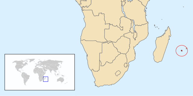
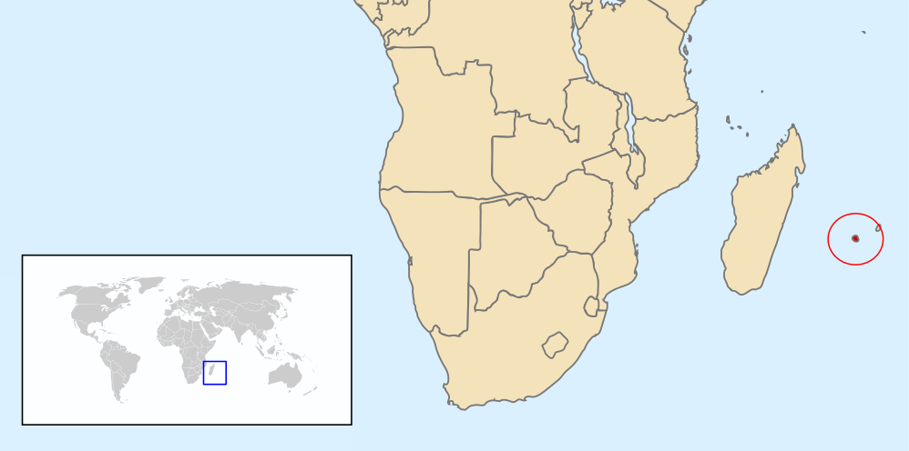
| Ìjúwe | Map of Renunion based on Image:A large blank world map with oceans marked in blue.svg |
| Ọjọ́ọdún | |
| Orísun | Iṣẹ́ onítọ̀hún |
| Olùdá | Chris huh |
Ìwé àṣẹ
| Èmi gangan, tó jẹ́ pé èmi ni mo ni ẹ̀tọ́àwòkọ iṣẹ́ yìí, jọ̀wọ́ ìṣẹ́ yìí sínú ìgboro. Èyí kan gbogbo ayé. In some countries this may not be legally possible; if so: I grant anyone the right to use this work for any purpose, without any conditions, unless such conditions are required by law. |
Ìtàn fáìlì
Ẹ kan kliki lórí ọjọ́ọdún/àkókò kan láti wo fáìlì ọ̀ún bó ṣe hàn ní àkókò na.
| Ọjọ́ọdún/Àkókò | Àwòrán kékeré | Àwọn ìwọ̀n | Oníṣe | Àríwí | |
|---|---|---|---|---|---|
| lọ́wọ́ | 07:49, 12 Oṣù Kejì 2013 | | 998 × 496 (4.15 MB) | Citypeek | removal border, clip |
| 21:06, 6 Oṣù Kàrún 2008 |  | 1,000 × 500 (2.76 MB) | Chris huh | ||
| 21:00, 6 Oṣù Kàrún 2008 |  | 1,000 × 500 (2.76 MB) | Chris huh | {{Information |Description=Map of Renunion based on Image:A large blank world map with oceans marked in blue.svg |Source=self-made |Date=6 May 2008 |Author= Chris huh |Permission= |other_versions= }} [[Category:Locator maps of cou |
Ìlò fáìlì
Ojúewé kan yìí únlo fáìlì yí:
Ìlò fáìlì káàkiri
Àwọn wiki míràn wọ̀nyí lo fáìlì yìí:
- Ìlò ní af.wikipedia.org
- Ìlò ní am.wikipedia.org
- Ìlò ní ar.wikipedia.org
- Ìlò ní ban.wikipedia.org
- Ìlò ní bg.wikipedia.org
- Ìlò ní bjn.wikipedia.org
- Ìlò ní ca.wikipedia.org
- Ìlò ní ceb.wikipedia.org
- Ìlò ní cs.wikipedia.org
- Ìlò ní en.wikipedia.org
- Ìlò ní eo.wikipedia.org
- Ìlò ní es.wikipedia.org
- Ìlò ní et.wikipedia.org
- Ìlò ní eu.wikipedia.org
- Ìlò ní fa.wikipedia.org
- Ìlò ní fr.wikipedia.org
- Ìlò ní ha.wikipedia.org
- Ìlò ní hif.wikipedia.org
- Ìlò ní hu.wikipedia.org
- Ìlò ní id.wikipedia.org
- Ìlò ní it.wikipedia.org
- Ìlò ní ka.wikipedia.org
- Ìlò ní mk.wikipedia.org
- Ìlò ní nl.wikipedia.org
- Ìlò ní no.wikipedia.org
- Ìlò ní pl.wikipedia.org
- Ìlò ní pnb.wikipedia.org
- Ìlò ní pt.wikipedia.org
Ìfihàn ìlò míràn púpọ̀ fún fálì yìí.