Fáìlì:BlankMap-Europe.png

Page contents not supported in other languages.
Lát'ọwọ́ Wikipedia, ìwé ìmọ̀ ọ̀fẹ́

BlankMap-Europe.png(450 × 422 pixel, ìtóbi faili: 15 KB, irú MIME: image/png)

Àkótán

Ìjúwe
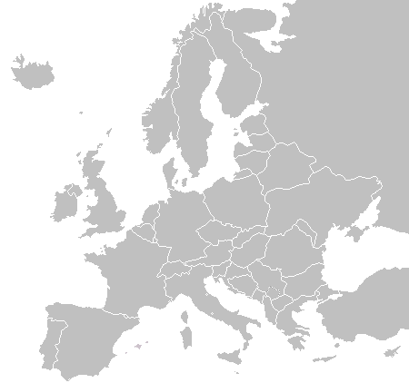
English: A blank political map of Europe as of 2004 (updated 2006 and 2008), made by the uploader for Wikipedia.
The list of independent states pictured on the map (source): Albania, Andorra, Austria, Belarus, Belgium, Bosnia and Herzegovina, Bulgaria, Croatia, Czech Republic, Cyprus, Denmark, Estonia, Finland, France, Germany, Greece, Hungary, Iceland, Ireland, Italy, Latvia, Liechtenstein, Lithuania, Luxembourg, Kosovo (disputed), Macedonia, Moldova, Monaco, Montenegro, Netherlands, Norway, Poland, Portugal, Romania, Russia, San Marino, Serbia, Slovakia, Slovenia, Spain, Sweden, Switzerland, Turkey, Ukraine, United Kingdom, Vatican City
Ọjọ́ọdún 16 Oṣù Kọkànlá 2003 (original upload date)
Orísun Iṣẹ́ onítọ̀hún
Olùdá Vardion at Èdè Gẹ̀ẹ́sì Wikipédìà

Ìwé àṣẹ

Public domain Èmi gangan, tó jẹ́ pé èmi ni mo ni ẹ̀tọ́àwòkọ iṣẹ́ yìí, jọ̀wọ́ ìṣẹ́ yìí sínú ìgboro. Èyí kan gbogbo ayé.
In some countries this may not be legally possible; if so:
I grant anyone the right to use this work for any purpose, without any conditions, unless such conditions are required by law.

Original upload log

The original description page was here. All following user names refer to en.wikipedia.
  • 2006-06-10 12:08 Astrokey44 422×422 (10216 bytes) montenegro independent
  • 2006-04-23 18:32 Lgriot 450×422 (7164 bytes) Reverted to earlier revision
  • 2006-04-23 18:32 Lgriot 415×422 (9421 bytes) Reverted to earlier revision
  • 2006-02-22 07:01 BionicWilliam 450×422 (9812 bytes) Reverted to earlier revision
  • 2006-02-22 07:01 BionicWilliam 415×422 (9421 bytes) Reverted to earlier revision
  • 2006-01-04 08:52 E Pluribus Anthony 450×422 (9812 bytes) Blank map of Europe (2005)
  • 2005-09-22 18:14 E Pluribus Anthony 450×422 (9805 bytes) Blank map of Europe (2005)
  • 2005-09-19 09:15 E Pluribus Anthony 450×422 (9804 bytes) Blank map of Europe, 2005
  • 2005-09-19 06:45 E Pluribus Anthony 450×422 (7164 bytes) Blank map of Europe
  • 2005-07-21 05:05 MishaChan 415×422 (5477 bytes) Reverted to earlier revision
  • 2005-07-21 05:04 MishaChan 415×422 (9421 bytes) Reverted to earlier revision
  • 2005-01-22 16:48 Richie 415×422 (5477 bytes) modified Ireland (border), Orkney, Shetlands
  • 2004-09-07 10:53 Gobnuts 415×422 (9421 bytes) Reverted to earlier revision
  • 2004-09-07 10:51 Gobnuts 415×422 (9410 bytes) Reverted to earlier revision
  • 2003-11-16 08:07 Vardion 415×422 (9421 bytes) Blank map of Europe (corrected again)
  • 2003-11-16 08:04 Vardion 415×422 (9410 bytes) Blank map of Europe (corrected)
  • 2003-11-16 07:16 Vardion 415×430 (9113 bytes) Blank map of Europe

akole

Ṣafikun alaye ila kan ti ohun ti faili yii duro

Awọn nkan ṣe afihan ninu faili yii

depicts Èdè Gẹ̀ẹ́sì

16 Oṣù Kọkànlá 2003

MIME type Èdè Gẹ̀ẹ́sì

image/png

source of file Èdè Gẹ̀ẹ́sì

original creation by uploader Èdè Gẹ̀ẹ́sì

checksum Èdè Gẹ̀ẹ́sì

fd8d2f1165f0bd5741de4e44d0bdfd3444feb56e

determination method Èdè Gẹ̀ẹ́sì: SHA-1 Èdè Gẹ̀ẹ́sì

data size Èdè Gẹ̀ẹ́sì

14,906 byte

height Èdè Gẹ̀ẹ́sì

422 pixel

width Èdè Gẹ̀ẹ́sì

450 pixel

Ìtàn fáìlì

Ẹ kan kliki lórí ọjọ́ọdún/àkókò kan láti wo fáìlì ọ̀ún bó ṣe hàn ní àkókò na.

(tuntunjùlọ | pípẹ́jùlọ) Ẹ wo (tuntunjùlọ 10 | ) (10 | 20 | 50 | 100 | 250 | 500)
Ọjọ́ọdún/ÀkókòÀwòrán kékeréÀwọn ìwọ̀nOníṣeÀríwí
lọ́wọ́22:02, 23 Oṣù Kẹ̀sán 2015Àwòrán kékeré fún ní 22:02, 23 Oṣù Kẹ̀sán 2015450 × 422 (15 KB)OgreBot(BOT): Reverting to most recent version before archival
22:02, 23 Oṣù Kẹ̀sán 2015Àwòrán kékeré fún ní 22:02, 23 Oṣù Kẹ̀sán 2015450 × 422 (10 KB)OgreBot(BOT): Uploading old version of file from en.wikipedia; originally uploaded on 2006-01-04 08:52:21 by E Pluribus Anthony
22:02, 23 Oṣù Kẹ̀sán 2015Àwòrán kékeré fún ní 22:02, 23 Oṣù Kẹ̀sán 2015450 × 422 (10 KB)OgreBot(BOT): Uploading old version of file from en.wikipedia; originally uploaded on 2005-09-22 18:14:10 by E Pluribus Anthony
22:02, 23 Oṣù Kẹ̀sán 2015Àwòrán kékeré fún ní 22:02, 23 Oṣù Kẹ̀sán 2015450 × 422 (10 KB)OgreBot(BOT): Uploading old version of file from en.wikipedia; originally uploaded on 2005-09-19 09:15:43 by E Pluribus Anthony
22:02, 23 Oṣù Kẹ̀sán 2015Àwòrán kékeré fún ní 22:02, 23 Oṣù Kẹ̀sán 2015450 × 422 (7 KB)OgreBot(BOT): Uploading old version of file from en.wikipedia; originally uploaded on 2005-09-19 06:45:22 by E Pluribus Anthony
22:02, 23 Oṣù Kẹ̀sán 2015Àwòrán kékeré fún ní 22:02, 23 Oṣù Kẹ̀sán 2015415 × 422 (5 KB)OgreBot(BOT): Uploading old version of file from en.wikipedia; originally uploaded on 2005-01-22 16:48:46 by Richie
22:01, 23 Oṣù Kẹ̀sán 2015Àwòrán kékeré fún ní 22:01, 23 Oṣù Kẹ̀sán 2015415 × 422 (9 KB)OgreBot(BOT): Uploading old version of file from en.wikipedia; originally uploaded on 2003-11-16 08:04:27 by Vardion
22:01, 23 Oṣù Kẹ̀sán 2015Àwòrán kékeré fún ní 22:01, 23 Oṣù Kẹ̀sán 2015415 × 430 (9 KB)OgreBot(BOT): Uploading old version of file from en.wikipedia; originally uploaded on 2003-11-16 07:16:14 by Vardion
19:27, 21 Oṣù Keje 2009Àwòrán kékeré fún ní 19:27, 21 Oṣù Keje 2009450 × 422 (15 KB)Hoshiefixed Montenegro
08:20, 18 Oṣù Keje 2009Àwòrán kékeré fún ní 08:20, 18 Oṣù Keje 2009450 × 422 (15 KB)Hoshieredid Kosovo/Montenegro borders based on an older version of File:Continental-Europe-map.png; anti-aliasing has been removed.
(tuntunjùlọ | pípẹ́jùlọ) Ẹ wo (tuntunjùlọ 10 | ) (10 | 20 | 50 | 100 | 250 | 500)

Kò sí ojúewé tó únlo fáìlì yìí.

Ìlò fáìlì káàkiri

Àwọn wiki míràn wọ̀nyí lo fáìlì yìí:

Metadata