
Fáìlì:Continental-Europe-map.png
Kò sí ìgbéhàn gíga jù báun lọ.
Continental-Europe-map.png (415 × 422 pixel, ìtóbi faili: 12 KB, irú MIME: image/png)
|
|
Fáìlì yìí wá láti Wikimedia Commons. Àròyé láti ojúewé ìjúwe rẹ̀ níbẹ̀ nìyí nísàlẹ̀. |
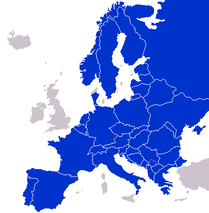
A map of Continental Europe.
| Èmi gangan, tó jẹ́ pé èmi ni mo ni ẹ̀tọ́àwòkọ iṣẹ́ yìí, jọ̀wọ́ ìṣẹ́ yìí sínú ìgboro. Èyí kan gbogbo ayé. In some countries this may not be legally possible; if so: I grant anyone the right to use this work for any purpose, without any conditions, unless such conditions are required by law. |
derivative works
Derivative works of this file: Kontinentet.png

|
This locator map image could be re-created using vector graphics as an SVG file. This has several advantages; see Commons:Media for cleanup for more information. If an SVG form of this image is available, please upload it and afterwards replace this template with
{{vector version available|new image name}}.
It is recommended to name the SVG file “Continental-Europe-map.svg”—then the template Vector version available (or Vva) does not need the new image name parameter. |
Ìtàn fáìlì
Ẹ kan kliki lórí ọjọ́ọdún/àkókò kan láti wo fáìlì ọ̀ún bó ṣe hàn ní àkókò na.
| Ọjọ́ọdún/Àkókò | Àwòrán kékeré | Àwọn ìwọ̀n | Oníṣe | Àríwí | |
|---|---|---|---|---|---|
| lọ́wọ́ | 01:47, 8 Oṣù Kẹ̀sán 2023 | | 415 × 422 (12 KB) | Sariyr | Exit Vendsyssel-Thy (Denmark) |
| 08:06, 18 Oṣù Keje 2009 |  | 415 × 422 (14 KB) | Hoshie | redid Kosovo/Montenegro borders based on Cradel's older map; anti-alasing has been removed. | |
| 10:18, 27 Oṣù Kẹ̀sán 2008 |  | 415 × 422 (14 KB) | Hoshie | readded Kosovo in a different way. See talk. | |
| 03:18, 25 Oṣù Kẹ̀sán 2008 |  | 415 × 422 (14 KB) | Hoshie | added Montenegro and fix the tripoint between Albania, Serbia/Kosovo and Montenegro | |
| 15:40, 16 Oṣù Kẹ̀sán 2008 |  | 415 × 422 (10 KB) | Tocino | Reverted to version as of 00:00, 16 September 2008 | |
| 10:06, 16 Oṣù Kẹ̀sán 2008 |  | 415 × 422 (10 KB) | Cradel | Reverted to version as of 20:45, 15 September 2008 | |
| 00:00, 16 Oṣù Kẹ̀sán 2008 |  | 415 × 422 (10 KB) | Tocino | Reverted to version as of 17:25, 15 September 2008 | |
| 20:45, 15 Oṣù Kẹ̀sán 2008 |  | 415 × 422 (10 KB) | Cradel | Reverted to version as of 11:56, 14 September 2008 | |
| 17:25, 15 Oṣù Kẹ̀sán 2008 |  | 415 × 422 (10 KB) | Tocino | Reverted to version as of 14:24, 12 January 2008 | |
| 11:56, 14 Oṣù Kẹ̀sán 2008 |  | 415 × 422 (10 KB) | Cradel | fix |
Ìlò fáìlì
Kò sí ojúewé tó únlo fáìlì yìí.
Ìlò fáìlì káàkiri
Àwọn wiki míràn wọ̀nyí lo fáìlì yìí:
- Ìlò ní ar.wikipedia.org
- Ìlò ní az.wikipedia.org
- Ìlò ní bs.wikipedia.org
- Ìlò ní ca.wikipedia.org
- Ìlò ní ckb.wikipedia.org
- Ìlò ní da.wikipedia.org
- Ìlò ní de.wikipedia.org
- Ìlò ní en.wikipedia.org
- Ìlò ní eo.wikipedia.org
- Ìlò ní es.wikipedia.org
- Ìlò ní eu.wikipedia.org
- Ìlò ní fa.wikipedia.org
- Ìlò ní fi.wikipedia.org
- Ìlò ní fo.wikipedia.org
- Ìlò ní gl.wikipedia.org
- Ìlò ní hy.wikipedia.org
- Ìlò ní id.wikipedia.org
- Ìlò ní is.wikipedia.org
- Ìlò ní it.wikipedia.org
- Ìlò ní ja.wikipedia.org
- Ìlò ní kk.wikipedia.org
- Ìlò ní ko.wikipedia.org
- Ìlò ní nl.wikipedia.org
- Ìlò ní nn.wikipedia.org
- Ìlò ní pl.wikipedia.org
- Ìlò ní pt.wikipedia.org
- Ìlò ní ro.wikipedia.org
- Ìlò ní ru.wikipedia.org
- Ìlò ní sco.wikipedia.org
- Ìlò ní sv.wikipedia.org
- Ìlò ní th.wikipedia.org
- Ìlò ní tr.wikipedia.org
- Ìlò ní uk.wikipedia.org
- Ìlò ní www.wikidata.org