Fáìlì:Makambako.png

Page contents not supported in other languages.
Lát'ọwọ́ Wikipedia, ìwé ìmọ̀ ọ̀fẹ́

Fáìlì àtìbẹ̀rẹ̀(538 × 610 pixel, ìtóbi faili: 716 KB, irú MIME: image/png)

Àkótán

This map image could be re-created using vector graphics as an SVG file. This has several advantages; see Commons:Media for cleanup for more information. If an SVG form of this image is available, please upload it and afterwards replace this template with {{vector version available|new image name}}.


It is recommended to name the SVG file “Makambako.svg”—then the template Vector version available (or Vva) does not need the new image name parameter.
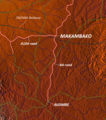
Ìjúwe Map of Makambako, Njombe District, Tanzania
Ọjọ́ọdún
Orísun http://www.maps-for-free.com/
Olùdá Modified by Dr. Blofeld
Ìyọ̀nda
(Ìtúnlò fáìlì yìí)
http://www.maps-for-free.com/html/about.html

Ìwé àṣẹ

This screenshot either does not contain copyright-eligible parts or visuals of copyrighted software, or the author has released it under a free license (which should be indicated beneath this notice), and as such follows the licensing guidelines for screenshots of Wikimedia Commons. You may use it freely according to its particular license. Free software license:

GNU head

Iṣẹ́ yìí jẹ́ atòlànà kọ̀mpútà ọ̀fẹ́; ẹ le ṣàtúnpínkiri rẹ̀ àti/tàbí ṣàtúnṣe rẹ̀ lábẹ́ àwọn ọ̀rọ̀ àdéhùn GNU General Public License gẹ́gẹ́ bí wọ́n ti jẹ́ títẹ̀jáde látọwọ́ Free Software Foundation; bóyá ó jẹ́ Ìwé-àṣẹ àtẹ̀jáde 2 tàbí àtẹ̀jáde ọjọ́ọwájú yìọ́wù. Iṣẹ́ yìí jẹ́ pípínkákiri pẹ̀lú ìrètí pé yí ò wúlò, sùgbọ́n lái sí ìdọ́jàpadà; láìsí ìdọ́jàpadà ìdúnàdúrà tàbí ìṣemímúlò fún ohun pàtó kan gan. Ẹ wo àtẹ̀jáde 2 àti àtẹ̀jáde 3 ti GNU General Public License fún ẹ̀kúnrẹ́rẹ́.

Note: if the screenshot shows any work that is not a direct result of the program code itself, such as a text or graphics that are not part of the program, the license for that work must be indicated separately.


Ìwé àṣẹ

w:en:Creative Commons
ìdárúkọ
Fáìlì yìí wà lábẹ́ ìwé àṣẹ Creative Commons Ìdálórúkọ 3.0 Aláìkówọlé.
Ẹ ní ààyè:
  • láti pín pẹ̀lú ẹlòmíràn – láti ṣàwòkọ, pínkiri àti ṣàgbéká iṣẹ́ náà
  • láti túndàpọ̀ – láti mulò mọ́ iṣẹ́ míràn
Lábẹ́ àwọn àdéhùn wọ̀nyí:
  • ìdárúkọ – Ẹ gbọdọ̀ ṣe ọ̀wọ̀ tó yẹ, pèsè ìjápọ̀ sí ìwé-àṣe, kí ẹ sì sọ bóyá ìyípadà wáyé. Ẹ le ṣe èyí lórísi ọ̀nà tó bojúmu, sùgbọ́n tí kò ní dà bii pé oníìwé-àṣe fọwọ́ sí yín tàbí lílò yín.

akole

Ṣafikun alaye ila kan ti ohun ti faili yii duro

Awọn nkan ṣe afihan ninu faili yii

depicts Èdè Gẹ̀ẹ́sì

copyright status Èdè Gẹ̀ẹ́sì

copyrighted Èdè Gẹ̀ẹ́sì

24 Oṣù Kẹ̀wá 2010

media type Èdè Gẹ̀ẹ́sì

image/png

Ìtàn fáìlì

Ẹ kan kliki lórí ọjọ́ọdún/àkókò kan láti wo fáìlì ọ̀ún bó ṣe hàn ní àkókò na.

Ọjọ́ọdún/ÀkókòÀwòrán kékeréÀwọn ìwọ̀nOníṣeÀríwí
lọ́wọ́11:18, 24 Oṣù Kẹ̀wá 2010Àwòrán kékeré fún ní 11:18, 24 Oṣù Kẹ̀wá 2010538 × 610 (716 KB)Blofeld Dr.== Summary == {{convert to SVG|map}} {{Information |Description=Map of Makambako, Njombe District, Tanzania |Source=http://www.maps-for-free.com/ |Date=2010-10-24 |Author=Modified by Dr. Blofeld |Permission=http://www.maps-for-free.com/html/about.html |ot

Ojúewé kan yìí únlo fáìlì yí:

Ìlò fáìlì káàkiri

Àwọn wiki míràn wọ̀nyí lo fáìlì yìí: