
Fáìlì:Mbini.PNG
Fáìlì àtìbẹ̀rẹ̀ (1,918 × 1,382 pixel, ìtóbi faili: 998 KB, irú MIME: image/png)
|
|
Fáìlì yìí wá láti Wikimedia Commons. Àròyé láti ojúewé ìjúwe rẹ̀ níbẹ̀ nìyí nísàlẹ̀. |
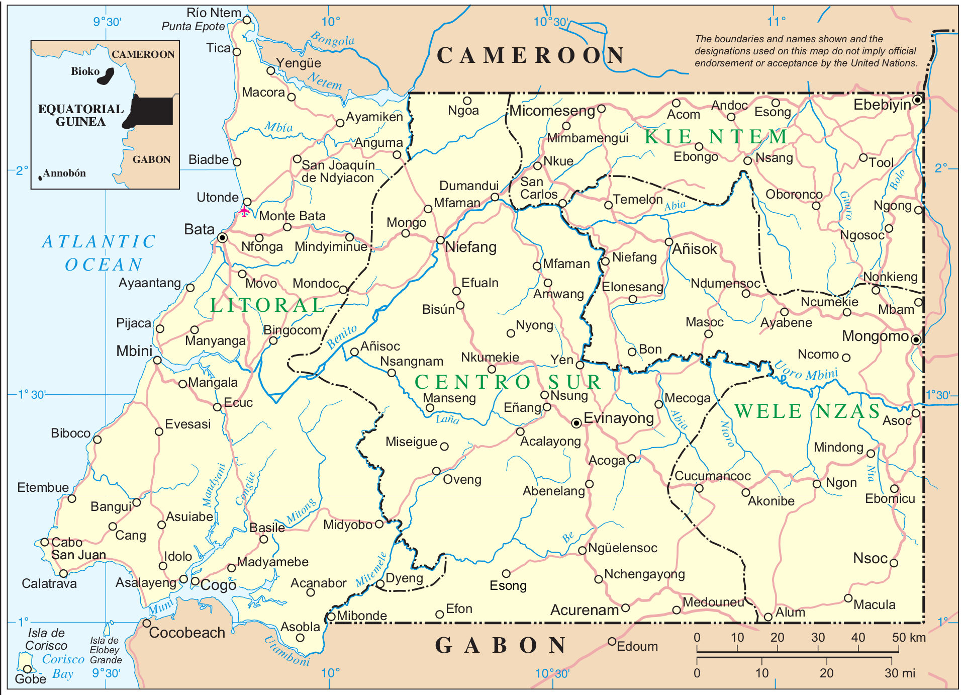
Mapa de Mbini. Guinea Ecuatorial
| This image is a map derived from a United Nations map.
Unless stated otherwise, UN maps are to be considered in the public domain. This applies worldwide. UN maps are, in principle, open source material and you can use them in your work or for making your own map. UN requests however that you delete the UN name, logo and reference number upon any modification to the map. Content of your map will be your responsibility. You can state in your publication, if you wish, something like: based on UN map … (map name, map number, revision number and date). See: Geospatial Information Section. And: Geospatial, location data for a better world. |
 |
Fuente: http://www.un.org/Depts/Cartographic/map/profile/eqguinea.pdf
Ìtàn fáìlì
Ẹ kan kliki lórí ọjọ́ọdún/àkókò kan láti wo fáìlì ọ̀ún bó ṣe hàn ní àkókò na.
| Ọjọ́ọdún/Àkókò | Àwòrán kékeré | Àwọn ìwọ̀n | Oníṣe | Àríwí | |
|---|---|---|---|---|---|
| lọ́wọ́ | 11:12, 7 Oṣù Kẹ̀sán 2014 | | 1,918 × 1,382 (998 KB) | Basquetteur | Higher resolution map |
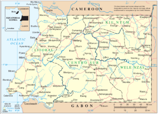
| 03:49, 20 Oṣù Kàrún 2005 |  | 844 × 606 (142 KB) | Taichi | Mapa de Mbini. Guinea Ecuatorial {{PD}} Fuente: http://www.un.org/Depts/Cartographic/map/profile/eqguinea.pdf |
Ìlò fáìlì
Ojúewé kan yìí únlo fáìlì yí:
Ìlò fáìlì káàkiri
Àwọn wiki míràn wọ̀nyí lo fáìlì yìí:
- Ìlò ní af.wikipedia.org
- Ìlò ní an.wikipedia.org
- Ìlò ní ast.wikipedia.org
- Ìlò ní bg.wikipedia.org
- Ìlò ní ca.wikipedia.org
- Ìlò ní de.wikipedia.org
- Ìlò ní de.wikivoyage.org
- Ìlò ní en.wikipedia.org
- Ìlò ní eo.wikipedia.org
- Ìlò ní es.wikipedia.org
- Ìlò ní eu.wikipedia.org
- Ìlò ní ff.wikipedia.org
- Ìlò ní fi.wikipedia.org
- Ìlò ní fr.wikipedia.org
- Ìlò ní fr.wiktionary.org
- Ìlò ní gl.wikipedia.org
- Ìlò ní ha.wikipedia.org
- Ìlò ní hr.wikipedia.org
- Ìlò ní ig.wikipedia.org
- Ìlò ní it.wikipedia.org
- Ìlò ní it.wikivoyage.org
- Ìlò ní ja.wikipedia.org
- Ìlò ní ka.wikipedia.org
- Ìlò ní ko.wikipedia.org
Ìfihàn ìlò míràn púpọ̀ fún fálì yìí.