
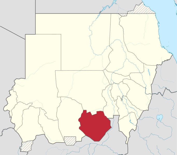
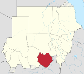
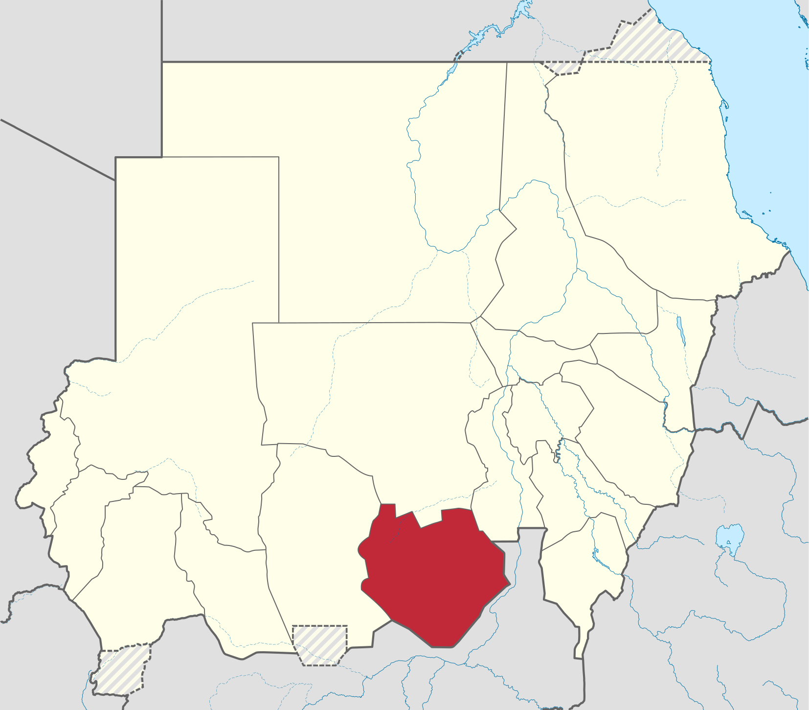
Fáìlì:South Kurdufan in Sudan (Kafia Kingi disputed).svg

Size of this PNG preview of this SVG file: 684 × 600 pixels. Àwọn ìgbéhàn míràn: 274 × 240 pixels | 548 × 480 pixels | 876 × 768 pixels | 1,168 × 1,024 pixels | 2,336 × 2,048 pixels | 1,654 × 1,450 pixels.
Fáìlì àtìbẹ̀rẹ̀ (faili SVG, pẹ̀lú 1,654 × 1,450 pixels, ìtòbi faili: 353 KB)
|
|
Fáìlì yìí wá láti Wikimedia Commons. Àròyé láti ojúewé ìjúwe rẹ̀ níbẹ̀ nìyí nísàlẹ̀. |
Àkótán
.svg)
.svg)
.svg)
.svg)
.svg)
.svg)
.svg)

-en.svg)

.svg)
.svg)
.svg)

_(US48).svg)
_(small_islands_magnified)_(-mini_map_-rivers).svg)
.svg)
_(extra_close)_(US48).svg)
.svg)
_(zoom).svg)

.svg)


_(UNMIK).svg)
.svg)
_(disputed_hatched).svg)
_(claimed_and_disputed_hatched).svg)
.svg)
.svg)
_(%2Ball_claims_hatched).svg)

.svg)
_(shade).svg)
_(shade)_(special_marker).svg)
_(-mini_map).svg)
_(-mini_map).svg)
_(-mini_map).svg)


.svg)

.svg)
.svg)
Ìwé àṣẹ
Èmi gangan, tó jẹ́ pé èmi ni mo ni ẹ̀tọ́àwòkọ iṣẹ́ yìí, fara mọ́ ọ láti tẹ̀ẹ́jáde lábẹ́ ìwé-àṣẹ ìsàlẹ̀ yìí:
Fáìlì yìí wà lábẹ́ ìwé àṣẹ Creative Commons Ìdálórúkọ-Share Alike 3.0 Aláìkówọlé.
- Ẹ ní ààyè:
- láti pín pẹ̀lú ẹlòmíràn – láti ṣàwòkọ, pínkiri àti ṣàgbéká iṣẹ́ náà
- láti túndàpọ̀ – láti mulò mọ́ iṣẹ́ míràn
- Lábẹ́ àwọn àdéhùn wọ̀nyí:
- ìdárúkọ – Ẹ gbọdọ̀ ṣe ọ̀wọ̀ tó yẹ, pèsè ìjápọ̀ sí ìwé-àṣe, kí ẹ sì sọ bóyá ìyípadà wáyé. Ẹ le ṣe èyí lórísi ọ̀nà tó bojúmu, sùgbọ́n tí kò ní dà bii pé oníìwé-àṣe fọwọ́ sí yín tàbí lílò yín.
- share alike – Tó bá ṣe pé ẹ ṣ'àtúndàlú, ṣàyípadà, tàbí ṣ'àgbélé sí iṣẹ́-ọwọ́ náà, ẹ lè ṣe ìgbésíta àfikún yín lábẹ́ ìwé-àṣẹ kannáà tàbí tójọra mọ́ ti àtilẹ̀wa.

|
I'd greatly appreciate, that you attribute this media file to Wikimedia Commons, if used outside Wikipedia or Commons. For use in publications such as books, newspapers, blogs, websites, please insert here the following line:
|
.svg&action=edit&redlink=1)
Ìtàn fáìlì
Ẹ kan kliki lórí ọjọ́ọdún/àkókò kan láti wo fáìlì ọ̀ún bó ṣe hàn ní àkókò na.
| Ọjọ́ọdún/Àkókò | Àwòrán kékeré | Àwọn ìwọ̀n | Oníṣe | Àríwí | |
|---|---|---|---|---|---|
| lọ́wọ́ | 05:33, 28 Oṣù Kẹfà 2017 | | 1,654 × 1,450 (353 KB) | SUM1 | Reverted to version as of 17:30, 4 October 2014 (UTC) |
| 18:12, 4 Oṣù Kẹ̀wá 2014 |  | 1,654 × 1,450 (345 KB) | TUBS | Rv. Maybe you are right. But plz correct File:Sudan location map.svg before. The locator map only mirrorrs borders of the location map | |
| 17:30, 4 Oṣù Kẹ̀wá 2014 |  | 1,654 × 1,450 (353 KB) | Leftcry | Reverted to version as of 23:42, 17 September 2013 | |
| 21:42, 18 Oṣù Kẹ̀sán 2013 |  | 1,654 × 1,450 (345 KB) | TUBS | Reverted to version as of 21:55, 28 January 2013 plz correct location map before and provide sources | |
| 23:42, 17 Oṣù Kẹ̀sán 2013 |  | 1,654 × 1,450 (353 KB) | Spesh531 | west kurdufan reformed | |
| 21:55, 28 Oṣù Kínní 2013 |  | 1,654 × 1,450 (345 KB) | TUBS | ||
| 16:36, 23 Oṣù Kọkànlá 2011 |  | 1,654 × 1,450 (685 KB) | TUBS |
Ìlò fáìlì
Ojúewé kan yìí únlo fáìlì yí:
Ìlò fáìlì káàkiri
Àwọn wiki míràn wọ̀nyí lo fáìlì yìí:
- Ìlò ní ar.wikipedia.org
- Ìlò ní arz.wikipedia.org
- Ìlò ní azb.wikipedia.org
- Ìlò ní bg.wikipedia.org
- Ìlò ní bn.wikipedia.org
- Ìlò ní ca.wikipedia.org
- Ìlò ní cs.wikipedia.org
- Ìlò ní din.wikipedia.org
- Ìlò ní en.wikipedia.org
- Ìlò ní eo.wikipedia.org
- Ìlò ní es.wikipedia.org
- Ìlò ní fa.wikipedia.org
- Ìlò ní fi.wikipedia.org
- Ìlò ní frr.wikipedia.org
- Ìlò ní fr.wikipedia.org
- Ìlò ní ha.wikipedia.org
- Ìlò ní he.wikipedia.org
- Ìlò ní hu.wikipedia.org
- Ìlò ní hy.wikipedia.org
- Ìlò ní ig.wikipedia.org
- Ìlò ní io.wikipedia.org
- Ìlò ní ja.wikipedia.org
- Ìlò ní ka.wikipedia.org
- Ìlò ní ko.wikipedia.org
- Ìlò ní lv.wikipedia.org
- Ìlò ní nl.wikipedia.org
- Ìlò ní pl.wikipedia.org
- Ìlò ní pl.wikivoyage.org
- Ìlò ní pnb.wikipedia.org
- Ìlò ní pt.wikipedia.org
- Ìlò ní ro.wikipedia.org
- Ìlò ní ru.wikipedia.org
- Ìlò ní sh.wikipedia.org
- Ìlò ní sr.wikipedia.org
- Ìlò ní sv.wikipedia.org
- Ìlò ní sw.wikipedia.org
- Ìlò ní ts.wikipedia.org
- Ìlò ní uk.wikipedia.org
- Ìlò ní ur.wikipedia.org
- Ìlò ní vi.wikipedia.org
Ìfihàn ìlò míràn púpọ̀ fún fálì yìí.
.svg)
.svg)