
Fáìlì:Tahoua Region departments.png

Fáìlì àtìbẹ̀rẹ̀ (1,056 × 816 pixel, ìtóbi faili: 24 KB, irú MIME: image/png)
|
|
Fáìlì yìí wá láti Wikimedia Commons. Àròyé láti ojúewé ìjúwe rẹ̀ níbẹ̀ nìyí nísàlẹ̀. |
| Ìjúwe |
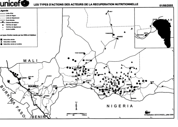
SummaryMap of the Departments of Tahoua Region, following the changes in administrative naming 1999-2005, with the addition of Abalak Department: a new subdivision created from the Tchin-tabaraden Department. Derived from Map of the arrondissements of Tahoua department in Niger. Created by Rarelibra 18:37, 13 September 2006 (UTC) for public domain use, using MapInfo Professional v8.5 and various mapping resources. See: fr:Tahoua (région) and en:Departments of Niger Image:Tahoua arrondissements.png http://www.senat.fr/rap/r04-512/r04-5128.gif Unicef Map http://www.fao.org/ag/agl/agll/wocat/wqasum.asp?questid=NIG05 FAO report http://www.fao.org/ag/agl/agll/wocat/img/qtnig7d.jpg FAO Map http://fr.wikipedia.org/wiki/Tahoua_%28r%C3%A9gion%29 Tahoua (région) * Département de Abalak Superficie: 77 445 km² (1) Population: 80 777 hts Centre urbaine: Ville d'Abalak |
| Ọjọ́ọdún | (UTC) |
| Orísun | |
| Olùdá |
|
| Àwọn àtẹ̀jáde míràn |
|

| This is a retouched picture, which means that it has been digitally altered from its original version. Modifications: added subdivision. The original can be viewed here: Tahoua arrondissements.png: File:Tahoua arrondissements.png. Modifications made by T L Miles.
|
| Èmi gangan, tó jẹ́ pé èmi ni mo ni ẹ̀tọ́àwòkọ iṣẹ́ yìí, jọ̀wọ́ ìṣẹ́ yìí sínú ìgboro. Èyí kan gbogbo ayé. In some countries this may not be legally possible; if so: I grant anyone the right to use this work for any purpose, without any conditions, unless such conditions are required by law. |
Original upload log
This image is a derivative work of the following images:
- Image:Tahoua_arrondissements.png licensed with PD-self
- 2006-11-10T12:48:31Z Béka 1056x816 (23579 Bytes) {{Information| |Description= == Summary == Map of the arrondissements of Tahoua department in Niger. Created by [[:en:User:Rarelibra|Rarelibra]] 18:37, 13 September 2006 (UTC) for public domain use, using MapInfo Professional
Uploaded with derivativeFX
Ìtàn fáìlì
Ẹ kan kliki lórí ọjọ́ọdún/àkókò kan láti wo fáìlì ọ̀ún bó ṣe hàn ní àkókò na.
| Ọjọ́ọdún/Àkókò | Àwòrán kékeré | Àwọn ìwọ̀n | Oníṣe | Àríwí | |
|---|---|---|---|---|---|
| lọ́wọ́ | 18:48, 19 Oṣù Kẹfà 2008 | | 1,056 × 816 (24 KB) | T L Miles | {{Information |Description=== Summary == Map of the Departments of Tahoua Region, following the changes in administrative naming 1999-2005, with the addition of Abalak Department: a new subdivision created from the Tchin-tabaraden Department. Derived f |
Ìlò fáìlì
Ojúewé kan yìí únlo fáìlì yí:
Ìlò fáìlì káàkiri
Àwọn wiki míràn wọ̀nyí lo fáìlì yìí:
- Ìlò ní da.wikipedia.org
- Ìlò ní de.wikipedia.org
- Ìlò ní en.wikipedia.org
- Ìlò ní es.wikipedia.org
- Ìlò ní fr.wikipedia.org
- Ìlò ní ha.wikipedia.org
- Ìlò ní ja.wikipedia.org
- Ìlò ní lv.wikipedia.org
- Ìlò ní pt.wikipedia.org
- Ìlò ní ro.wikipedia.org
- Ìlò ní ru.wikipedia.org
- Ìlò ní tr.wikipedia.org
- Ìlò ní ur.wikipedia.org
- Ìlò ní www.wikidata.org
Ìfihàn ìlò míràn púpọ̀ fún fálì yìí.