
Fáìlì:Iberian Peninsula antique map.jpg

Fáìlì àtìbẹ̀rẹ̀ (2,096 × 1,700 pixel, ìtóbi faili: 5.81 MB, irú MIME: image/jpeg)
|
|
Fáìlì yìí wá láti Wikimedia Commons. Àròyé láti ojúewé ìjúwe rẹ̀ níbẹ̀ nìyí nísàlẹ̀. |
|
Àkótán
| Ìjúwe |
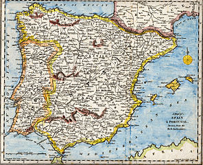
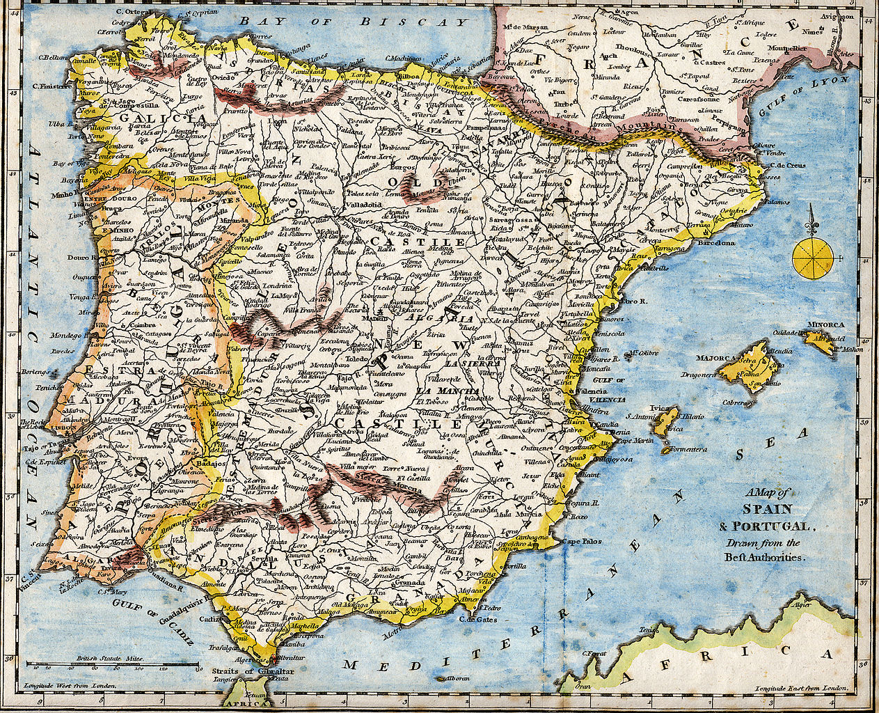
English: 18th century hand-coloured engraved map of the Iberian peninsula depicting various topographical features of the land, as published in Robert Wilkinson's General Atlas, circa 1794. (Volume 2., page 666.)
Titl'd A Map of Spain & Portugal, Drawn from the Beſt Authorities Español: Mapa del siglo XVIII grabado al cobre e iluminado a mano, representando varias características topográficas de la Península Ibérica. Publicado en el atlas general de Robert Wilkinson (volumen 2., página 666.)
Português: Mapa do século XVIII gravado em cobre e iluminado a mão, representando várias características topográficas da Península Ibérica. Publicado no atlas geral de Robert Wilkinson (volume 2., página 666.)
Català: Mapa del segle XVIII grabat al coure i il·luminat a mà, representant diverses característiques topogràfiques de la Península Ibèrica. Publicat en l'atles general de Robert Walkinson (volum 2., pàgina 666) |
|||||||||||||||||||
| Ọjọ́ọdún | circa 1794 | |||||||||||||||||||
| Orísun | Scanned from my personal collection. (scanned by User:RedCoat) | |||||||||||||||||||
| Olùdá |
|
|||||||||||||||||||
| Location | [published at] No. 58 Cornhill London, England | |||||||||||||||||||
Ìwé àṣẹ
|
This work is in the public domain in its country of origin and other countries and areas where the copyright term is the author's life plus 70 years or fewer.
| |
| This file has been identified as being free of known restrictions under copyright law, including all related and neighboring rights. | |
Ìtàn fáìlì
Ẹ kan kliki lórí ọjọ́ọdún/àkókò kan láti wo fáìlì ọ̀ún bó ṣe hàn ní àkókò na.
| Ọjọ́ọdún/Àkókò | Àwòrán kékeré | Àwọn ìwọ̀n | Oníṣe | Àríwí | |
|---|---|---|---|---|---|
| lọ́wọ́ | 17:01, 28 Oṣù Kẹ̀wá 2007 | | 2,096 × 1,700 (5.81 MB) | RedCoat | {{Information | Description ={{en|18th century hand-coloured engraved map of the Iberian peninsula depicting various topographical features of the land, as published in Robert Wilkinson's ''General Atlas'', circa 1794. |
Ìlò fáìlì
Àwọn ojúewé 2 wọ̀nyí únlo fáìlì yí:
Ìlò fáìlì káàkiri
Àwọn wiki míràn wọ̀nyí lo fáìlì yìí:
- Ìlò ní ar.wikipedia.org
- Ìlò ní ast.wikipedia.org
- Ìlò ní azb.wikipedia.org
- Ìlò ní ba.wikipedia.org
- Ìlò ní bg.wikipedia.org
- Ìlò ní ca.wikipedia.org
- Ìlò ní de.wikipedia.org
- Ìlò ní en.wikipedia.org
- History of Spain
- Portal:Spain
- Portal:Portugal
- Portal:Portugal/Recognized content
- Portal:European Union/Selected picture
- Portal:Maps/Selected picture
- Loa (Spanish play)
- Wikipedia:Featured pictures thumbs/07
- Wikipedia:WikiProject Portugal/FAC
- Portal:European Union/Selected picture/5
- Wikipedia:WikiProject Gibraltar
- Wikipedia:Featured picture candidates/July-2007
- Wikipedia:Wikipedia Signpost/2007-07-23/Features and admins
- Wikipedia:Featured picture candidates/Iberian Peninsula antique map.jpg
- Wikipedia:Wikipedia Signpost/2007-07-23/SPV
- Robert Wilkinson (cartographer)
- User talk:RedCoat10/Archive 2
- Portal:Maps/Selected picture/9
- Wikipedia:Picture of the day/November 2007
- Template:POTD/2007-11-11
- User talk:RedCoat10/Archive 3
- Portal:Spain/Exemplary content
- Wikipedia:Featured pictures/Diagrams, drawings, and maps/Maps
- Wikipedia:WikiProject Spain/Recognized content
- Iberian ship development, 1400–1600
- Portal:Geography/Selected picture
- Wikipedia:WikiProject Portugal/Recognized content
- Wikipedia:Wikipedia Signpost/Single/2007-07-23
- Ìlò ní es.wikipedia.org
- Ìlò ní eu.wikipedia.org
- Ìlò ní fa.wikipedia.org
- Ìlò ní it.wikipedia.org
- Ìlò ní mg.wikipedia.org
- Ìlò ní ml.wikipedia.org
- Ìlò ní ms.wikipedia.org
- Ìlò ní mwl.wikipedia.org
- Ìlò ní nn.wikipedia.org
Ìfihàn ìlò míràn púpọ̀ fún fálì yìí.