Lát'ọwọ́ Wikipedia, ìwé ìmọ̀ ọ̀fẹ́
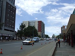
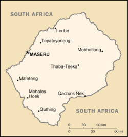
Maseru ni oluilu orile-ede Lesotho. Bakanna ibe tun ni ibujoko Ipinleagbegbe Maseru. O budo si eti Odo Mohokare, ni bode mo orile-ede Guusu Afrika, Maseru nikan ni ilu totobi ni Lesotho pelu olugbe to to 227,880 (2006).
|
|---|
| |
Abuja, Nigeria
Akra, Ghana
Addis Ababa, Ethiopia
Algiers, Algeria
Antananarivo, Madagascar
Asmara, Eritrea
Bamako, Mali
Bangui, Central African Republic
Banjul, Gambia
Bissau, Guinea-Bissau
Bloemfontein, South Africa 1
Brazzaville, Ol. Kongo
Bujumbura, Burundi
|
Káírò, Egypt
Cape Town, South Africa 2
Conakry, Guinea
Dakar, Senegal
Djibouti, Djibouti
Dodoma, Tanzania
Freetown, Sierra Leone
Gaborone, Botswana
Harare, Zimbabwe
Jamestown, Saint Helena
Kampala, Uganda
Khartoum, Sudan
Kigali, Rwanda
Kinshasa, OO Kongo
Libreville, Gabon
|
Lilongwe, Malawi
Lobamba, Swaziland 2
Lomé, Togo
Luanda, Angola
Lusaka, Zambia
Malabo, Equatorial Guinea
Mamoudzou, Mayotte
Maputo, Mozambique
Maseru, Lesotho
Mbabane, Swaziland 3
Mogadishu, Somalia
Monrovia, Liberia
Moroni, Comoros
Nouakchott, Mauritania
Niamey, Niger
|
N'Djamena, Chad
Nairobi, Kenya
Ouagadougou, Burkina Faso
Port Louis, Mauritius
Porto-Novo, Benin
Praia, Cape Verde
Pretoria, South Africa 3
Rabat, Morocco
Saint-Denis, Réunion
São Tomé, São Tomé and Príncipe
Tripoli, Libya
Tunis, Tunisia
Victoria, Seychelles
Windhoek, Namibia
Yaoundé, Cameroon
Yamoussoukro, Côte d'Ivoire
|
|
1 Adájọ́. 2 Aṣòfin. 3 Apàṣẹ. |
Coordinates: 29°19′S 27°29′E / 29.31°S 27.48°E / -29.31; 27.48


