Korea: Ìyàtọ̀ láàrin àwọn àtúnyẹ̀wò
Content deleted Content added
k Bot Fífikún: xal:Солңһудин Орн |
No edit summary |
||
| Ìlà 4: | Ìlà 4: | ||
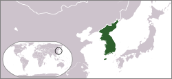
|image_map = Locator map of Korea.svg |
|image_map = Locator map of Korea.svg |
||
|official_languages = [[Korean language|Korean]] |
|official_languages = [[Korean language|Korean]] |
||
| |
|area_rank = 84th if reunified |
||
| ⚫ | |||
|latd=37 |latm=32 |latNS=N |longd=126 |longm=59 |longEW=E |
|||
| ⚫ | |||
|largest_settlement_type = conurbation (population) |
|||
|largest_settlement = [[Seoul]] |
|||
|area_rank = 84th if reunified |
|||
| ⚫ | |||
| ⚫ | |||
|percent_water = 2.8 |
|percent_water = 2.8 |
||
|population_estimate_rank = |
|population_estimate_rank = 18th if reunified |
||
|population_estimate_year = |
|population_estimate_year = 2010 |
||
|population_estimate = |
|population_estimate = 73,000,000<ref>[http://www.mt.co.kr/view/mtview.php?type=1&no=2007111812563466492&outlink=1 MT.co.kr]</ref> |
||
|population_density_km2 |
|population_density_km2 = 328.48 |
||
|population_density_sq_mi |
|population_density_sq_mi = 850.7 <!--Do not remove per [[WP:MOSNUM]]--> |
||
|currency = [[Korean won|Won]] ([[₩]]) ([[North Korean won|N]]/[[South Korean won|S]]) |
|currency = [[Korean won|Won]] ([[₩]]) ([[North Korean won|N]]/[[South Korean won|S]]) |
||
|time_zone = [[Korea Standard Time|KST]] |
|time_zone = [[Korea Standard Time|KST]] |
||
Àtúnyẹ̀wò ní 13:17, 25 Oṣù Keje 2010
Korea | |
|---|---|
 | |
| Àwọn èdè ìṣẹ́ọba | Korean |
| Ìtóbi | |
• Total | 223,170 km2 (86,170 sq mi) (84th if reunified) |
• Omi (%) | 2.8 |
| Alábùgbé | |
• 2010 estimate | 73,000,000[1] (18th if reunified) |
• Ìdìmọ́ra | 328.48/km2 (850.8/sq mi) |
| Owóníná | Won (₩) (N/S) |
| Ibi àkókò | UTC+9 (KST) |
| ISO 3166 code | KP |
Korea

|
Àyọkà yìí tàbí apá rẹ̀ únfẹ́ àtúnṣe sí. Ẹ le fẹ̀ jù báyìí lọ tàbí kí ẹ ṣàtúnṣe rẹ̀ lọ́nà tí yíò mu kúnrẹ́rẹ́. Ẹ ran Wikipedia lọ́wọ́ láti fẹ̀ẹ́ jù báyìí lọ. |
