Trenton
Ìrísí
City of Trenton, New Jersey | ||
|---|---|---|
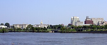
 Downtown Trenton, viewed from Morrisville, Pennsylvania | ||
| ||
| Nickname(s): Capitol City, Turning Point of the Revolution. | ||
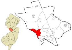
 Location of Trenton inside of Mercer County. Inset: Location of Mercer County highlighted in the State of New Jersey. | ||
| Country | United States | |
| County | Mercer | |
| Incorporated | November 13, 1792 | |
| Government | ||
| • Type | Faulkner Act (Mayor-Council) | |
| • Mayor | Douglas H. Palmer | |
| Area | ||
| • Total | 8.1 sq mi (21.1 km2) | |
| • Land | 7.6 sq mi (19.8 km2) | |
| • Water | 0.5 sq mi (1.3 km2) | |
| Elevation | 52 ft (16 m) | |
| Population (2007)[2] | ||
| • Total | 82,804 | |
| • Density | 11,153.6/sq mi (4,304.7/km2) | |
| Time zone | UTC-5 (Eastern (EST)) | |
| • Summer (DST) | UTC-4 (EDT) | |
| ZIP codes | 08608, 08609, 08610, 08611, 08618, 08619, 08620, 08625, 08628, 08629, 08638, 08641, 08648, 08650 | |
| Area code(s) | 609 | |
| FIPS code | 34-74000[3][4] | |
| GNIS feature ID | 0884540[5] | |
| Website | www.trentonnj.org | |
Trenton ni olúìlú of the ìpínlẹ̀ orílè-ède Amẹ́ríkà tó ń jẹ́̀ New Jersey ati ibùjóko ìbílẹ̀ Mercer County. Ní ọdún 2007 iye àwọn ènìyàn ibẹ̀ jẹ́ 82,804.[2]
Àwọn ìtọ́kasí
[àtúnṣe | àtúnṣe àmìọ̀rọ̀]- ↑ U.S. Geological Survey Geographic Names Information System: City of Trenton, Geographic Names Information System, accessed June 4, 2007.
- ↑ 2.0 2.1 Àṣìṣe ìtọ́kasí: Invalid
<ref>tag; no text was provided for refs namedCensusEst - ↑ "American FactFinder". United States Census Bureau. Retrieved 2008-01-31.
- ↑ A Cure for the Common Codes: New Jersey, Missouri Census Data Center. Accessed July 14, 2008.
- ↑ "US Board on Geographic Names". United States Geological Survey. 2007-10-25. Retrieved 2008-01-31.

