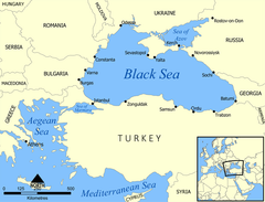
Òkun Dúdú
Ìrísí
| Òkun Dúdú | |
|---|---|

| |
| Satellite view of the Black Sea, taken by NASA MODIS | |

| |
| Coordinates | 44°N 35°E / 44°N 35°ECoordinates: 44°N 35°E / 44°N 35°E |
| Max. length | 1,175 km (730 mi) |
| Surface area | 436,400 km2 (168,500 sq mi) |
| Max. depth | 2,206 m (7,238 ft) |
| Water volume | 547,000 km3 (131,000 cu mi) |

Okun Dudu

|
Àyọkà yìí tàbí apá rẹ̀ únfẹ́ àtúnṣe sí. Ẹ le fẹ̀ jù báyìí lọ tàbí kí ẹ ṣàtúnṣe rẹ̀ lọ́nà tí yíò mu kúnrẹ́rẹ́. Ẹ ran Wikipedia lọ́wọ́ láti fẹ̀ẹ́ jù báyìí lọ. |
