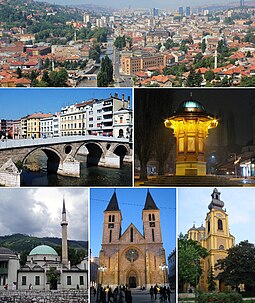
Sarajevo
Ìrísí
Sarajevo | |||
|---|---|---|---|
| City of Sarajevo Grad Sarajevo | |||
 | |||
| |||
 Bosnia and Herzegovina surrounding Sarajevo (dark green, center) | |||
| Country | |||
| Entity | Federation of Bosnia and Herzegovina | ||
| Canton | |||
| Municipalities | 4 | ||
| Government | |||
| • Mayor | Abdulah Skaka (SDA) | ||
| Area | |||
| • Urban | 141.5 km2 (54.6 sq mi) | ||
| Elevation | 500 m (1,640 ft) | ||
| Population (30 June 2009)[2] | |||
| • City | 305,242 | ||
| • Density | 2,157.2/km2 (5,587/sq mi) | ||
| • Urban | 305,242 | ||
| • Metro | 423,645 | ||
| • Demonym | Sarajevan | ||
| Time zone | UTC+1 (Central European Time) | ||
| Postal code | 71000 | ||
| Area code(s) | +387 (33) | ||
| Website | City of Sarajevo | ||

|
Àyọkà yìí tàbí apá rẹ̀ únfẹ́ àtúnṣe sí. Ẹ le fẹ̀ jù báyìí lọ tàbí kí ẹ ṣàtúnṣe rẹ̀ lọ́nà tí yíò mu kúnrẹ́rẹ́. Ẹ ran Wikipedia lọ́wọ́ láti fẹ̀ẹ́ jù báyìí lọ. |
Itokasi
[àtúnṣe | àtúnṣe àmìọ̀rọ̀]- ↑ Sarajevo Official Web Site. About Sarajevo. Retrieved on 4 March 2007.
- ↑ "First release" (PDF). Federal Office of Statistics, Federation of Bosnia and Herzegovina. 2009-09-09. Archived from the original (PDF) on 2014-04-01. Retrieved 2009-11-02.
- ↑ "Intercity and International Cooperation of the City of Zagreb". © 2006-2009 City of Zagreb. Archived from the original on 2017-07-07. Retrieved 2009-06-23.


