Saint-Denis, Réunion
Appearance
|
Saint-Denis | |

| |
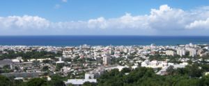
| Panoramic view of the city from the heights of Bellepierre. | |

| |
| Administration | |
|---|---|
| Country | France |
| Overseas region and department | Réunion |
| Arrondissement | Saint-Denis, Réunion |
| Canton | chef-lieu of 9 cantons |
| Intercommunality | CINOR |
| Mayor | Gilbert Annette (PS) (2008–2014) |
| Statistics | |
| Elevation | 0–2,276 m (0–7,467 ft) (avg. 23 m or 75 ft*) |
| Land area1 | 142.79 km2 (55.13 sq mi) |
| Population2 | 133,700 (2004 [1]) |
| - Density | 936/km2 (2,420/sq mi) |
| INSEE/Postal code | 97411/ 97400 |
| 1 French Land Register data, which excludes lakes, ponds, glaciers > 1 km² (0.386 sq mi or 247 acres) and river estuaries. | |
| 2 Population without double counting: residents of multiple communes (e.g., students and military personnel) only counted once. | |
Coordinates: Àdàkọ:FraAbbr/debug_type:city(133700) 20°52′44″S 55°26′53″E / 20.8789°S 55.4481°E
Saint-Denis (tabi Saint-Denis de la Réunion fun isojutuu) ni oluilu agbegbe ati apa France okere Réunion, to wa larin Okun India.

|
Àyọkà yìí tàbí apá rẹ̀ únfẹ́ àtúnṣe sí. Ẹ le fẹ̀ jù báyìí lọ tàbí kí ẹ ṣàtúnṣe rẹ̀ lọ́nà tí yíò mu kúnrẹ́rẹ́. Ẹ ran Wikipedia lọ́wọ́ láti fẹ̀ẹ́ jù báyìí lọ. |
Itokasi
[àtúnṣe | àtúnṣe àmìọ̀rọ̀]- ↑ 2004 estimate, 131,557 at the 1999 census
