Ìpínlẹ̀ Ògùn: Ìyàtọ̀ láàrin àwọn àtúnyẹ̀wò
Content deleted Content added
Removing Flag_of_Ogun_State.png, it has been deleted from Commons by Pi.1415926535 because: False claims of own work; doubts as to whether some are real. |
#WPWPTMZ #WPWPBI #WPWPPE |
||
| Ìlà 73: | Ìlà 73: | ||
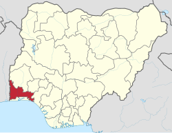
'''Ìpínlẹ̀ Ògùn''' je ikan ninu awon [[Awon Ipinle Naijiria|ipinle]] merindinlogoji ni orile-ede [[Naijiria]]. O je didasile ni [[1976]] lati Ipinle Iwoorun to wa tele. |
'''Ìpínlẹ̀ Ògùn''' je ikan ninu awon [[Awon Ipinle Naijiria|ipinle]] merindinlogoji ni orile-ede [[Naijiria]]. O je didasile ni [[1976]] lati Ipinle Iwoorun to wa tele. |
||
==Awon itokasi== |
|||
{{ẹ̀kúnrẹ́rẹ́}} |
|||
==Itokasi== |
|||
{{reflist}} |
{{reflist}} |
||
{{OgunStateGovernors}} |
{{OgunStateGovernors}} |
||
{{Ibile Ogun}} |
{{Ibile Ogun}} |
||
{{Ipinle Naijiria}} |
{{Ipinle Naijiria}} |
||
{{coord|7|00|N|3|35|E|region:NG_type:adm1st_source:GNS-enwiki|display=title}} |
{{coord|7|00|N|3|35|E|region:NG_type:adm1st_source:GNS-enwiki|display=title}} |
||
Àtúnyẹ̀wò ní 11:45, 17 Oṣù Kẹfà 2021
Ìpínlẹ̀ Ògùn | |
|---|---|
| Nickname(s): | |
 Ibudo Ìpínlẹ̀ Ògùn ni Naijiria | |
| Coordinates: 7°00′N 3°35′E / 7.000°N 3.583°ECoordinates: 7°00′N 3°35′E / 7.000°N 3.583°E | |
| Orile-ede | |
| Ojoodun idasile | 3 February 1976 |
| Oluilu | Abeokuta |
| Government | |
| • Gomina | Dapo Abiodun (APC) |
| • Deputy Governor | Noimot Salako-Oyedele |
| • Awon Alagba |
|
| • Ile-asofin | Ogun State House of Assembly |
| Area | |
| • Total | 16,980.55 km2 (6,556.23 sq mi) |
| Area rank | 24k ninu 36 |
| Population (2006 census) | |
| • Total | 3,751,140 |
| • Rank | 16k ninu 36 |
| • Density | 220/km2 (570/sq mi) |
| Demonym(s) | Ogun |
| GDP | |
| • Year | 2007 |
| • Total | $10.47 billion[1] |
| • Per capita | $2,740[1] |
| Time zone | UTC+01 (WAT) |
| ISO 3166 code | NG-OG |
| HDI (2016) | 0.549[2] · 7th of 36 |
Ìpínlẹ̀ Ògùn je ikan ninu awon ipinle merindinlogoji ni orile-ede Naijiria. O je didasile ni 1976 lati Ipinle Iwoorun to wa tele.
Awon itokasi
- ↑ 1.0 1.1 "C-GIDD (Canback Global Income Distribution Database)". Canback Dangel. Retrieved 2008-08-20.
- ↑ "National Human Development Report 2018" (PDF).
Coordinates: 7°00′N 3°35′E / 7.000°N 3.583°E{{#coordinates:}}: cannot have more than one primary tag per page

